Hurricane Dora
From Wikipedia, the free encyclopedia
| Category 4 hurricane (SSHS) | ||
|---|---|---|
 Radar image of Dora at landfall |
||
| Formed | August 28, 1964 | |
| Dissipated | September 16, 1964 | |
| Highest winds |
|
|
| Lowest pressure | 942 mbar (hPa; 27.83 inHg) | |
| Fatalities | 1 direct, 2 indirect | |
| Damage | $280 million (1964 USD) $1.9 billion (2008 USD) |
|
| Areas affected |
Northeast Florida, Georgia, South Carolina | |
| Part of the 1964 Atlantic hurricane season |
||
Hurricane Dora was the fourth named storm, second hurricane and one of six major hurricanes of the 1964 Atlantic hurricane season. Dora was the first and, to date, the only hurricane to make landfall on the First Coast region of Florida; more specifically, the metropolitan area of Jacksonville. Before it came ashore at St. Johns County just after midnight on September 10, 1964, no hurricane had struck northeast Florida from the east since record-keeping began in 1851.[1]
Dora left two billion dollars (2005 USD) in damage, most of it in Florida and only three fatalities (1 direct, 2 indirect) due to advanced warnings. Dora was one of three hurricanes to affect Florida during the 1964 season.
Contents |
[edit] Storm history

On August 28, a large low pressure system emerged off the African coast and passed near Cape Verde.[2] The low tracked west, and on August 31 an organize cloud pattern was spotted near 11°N., 41°W. The following day, it organized into a tropical depression. The depression was enveloped in a larger are of low pressure in which the pressure isobar of 1008 mb was 300 nautical miles wide at the time of formation, while minimum pressure was at 998 mb. The storm intensified under an area of light wind shear and was upgraded to Tropical Storm Dora on September 1, and was upgraded to a hurricane on September 2.[2]
Dora continued to intensify and grow in size, and while the storm was located 300 miles to the south of Bermuda, it turned west-northwest as opposed to the north-northwest track that Dora had previously maintained. It soon grew to a large, powerful hurricane with a minimum central pressure of 942 mb. The storm began to slow down in forward speed as lower-level inflow decreased causing a gradual weakening. Also attributed to the weakening of Dora was the outflow from dissipating Hurricane Cleo.[3] The storm slowed further and made landfall in northeast Florida near Jacksonville.[2]
The storm drifted west over northern Florida, and just as it reached the Gulf of Mexico, it executed a sharp turn to the northeast and paralleled the Carolinas before turning out to sea.[2] Dora weakened, and dissipated on September 14.[3]
[edit] Preparations
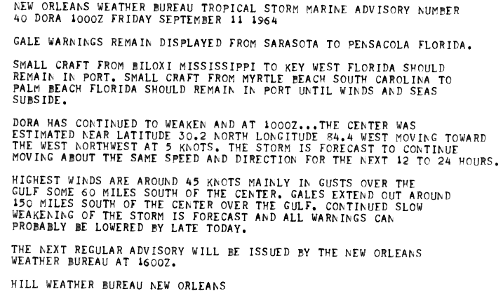
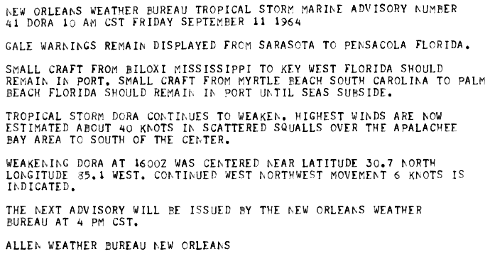
As Dora approached Florida, gale warnings were issued for the northeast section of the coastline.[4] As Dora moved inland, gale warnings were issued from Sarasota to Pensacola.[5] In addition, small craft for much of the Gulf Coast to the west coast of Florida, and later in the Mid-Atlantic were advised to stay in port until the storm subsided.[5]
[edit] Impact
The damage associated with Dora in Florida were moderate to severe in some places. However, only one person died directly as a result of the storm from a drowning in Live Oak.[6] Two other people, navy personnel, were killed when an aircraft that was being evacuated crashed at take-off.[2] Because of the slow movement of Dora, wind and flooding were major dangers as some areas bore the brunt of the storm for several hours and in some places up to a day.[2] When Dora made landfall near St. Augustine, points north of Daytona Beach received sustained winds of at least 100 mph, while in some places even more on the evening of September 9.[6]
In St. Augustine, the place of landfall, the city was in the eye of the storm from 12:15 A.M. EST until 1:30 A.M. EST. During that time period, the observer reported a minimum pressure of 28.52 hPa. Shortly after the eye's passage over the city, sustained winds of 125 mph were reported. Heavy rain overspread the city as the night progressed, totaling to 7.1 inches.[7]
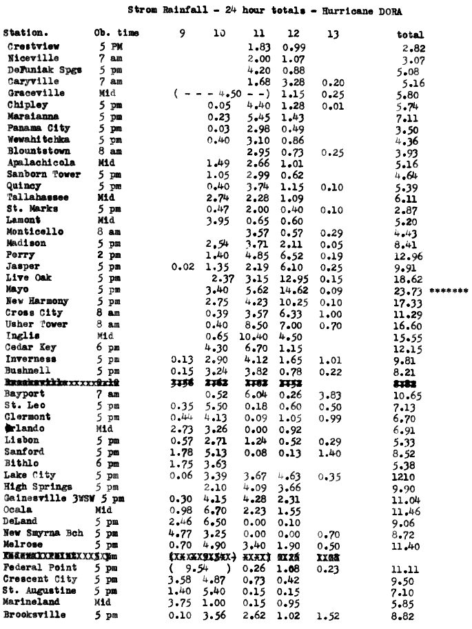
Power supply for Jacksonville and surrounding towns was lost for six days. A total of $280 million ($2 billion in 2005 dollars) in damage was attributed to the hurricane, primarily due to extensive inland flooding. The highest rainfall amount recorded during the hurricane fell at Mayo, where 23.73 inches fell.[8][9]
[edit] Retirement
- See also: List of retired Atlantic hurricane names
The name Dora, which had replaced Donna on the hurricane lists, was retired from the Atlantic hurricane lists and was replaced with Dolly for the 1968 season.
[edit] See also
- List of Atlantic hurricanes
- List of retired Atlantic hurricane names
- List of Florida hurricanes (1950-1974)
[edit] References
- ^ National Hurricane Center. Hurricane Database. Retrieved on 2008-01-30.
- ^ a b c d e f Gordon E. Dunn and staff. 1964 Monthly Weather Review. National Hurricane Center. Retrieved on 2008-02-01.
- ^ a b National Weather Bureau (1964). Hurricane Dora Preliminary Report. National Hurricane Center. Retrieved on 2008-02-01.
- ^ Hill Weather Bureau in New Orleans (1964). Hurricane Dora Public Advisory Number 40. National Hurricane Center. Retrieved on 2008-02-01.
- ^ a b Hill Weather Bureau in New Orleans (1964). Hurricane Dora Public Advisory Number 41. Retrieved on 2008-02-01.
- ^ a b National Weather Bureau (1964). Hurricane Dora, September 9-12, 1964. National Hurricane Center. Retrieved on 2008-02-01.
- ^ National Weather Bureau (1964). Hurricane Dora Rainfall. National Hurricane Center. Retrieved on 2008-02-01.
- ^ David M. Roth. Tropical Cyclone Point Maxima. Retrieved on 2007-04-14.
- ^ David M. Roth. Tropical Cyclone Point Maxima. Retrieved on 2007-04-14.
[edit] External links
- NHC 1964 Preliminary Report on Dora
- Historic Images of Florida Hurricanes (State Archives of Florida)
|
||||||||||||||||||||

