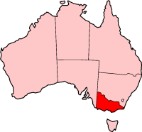
Image:VIC in Australia map.png
From Wikipedia, the free encyclopedia
No higher resolution available.
VIC_in_Australia_map.png (200 × 186 pixels, file size: 11 KB, MIME type: image/png)
| | This is a file from the Wikimedia Commons. The description on its description page there is shown below.
|
This image was copied from wikipedia:en. The original description was:

| date/time | username | edit summary |
|---|---|---|
| 03:33, 4 June 2004 | Template namespace initialisation script | |
| 21:13, 22 February 2004 | Morwen | |
| 04:45, 10 May 2003 | Tim Starling | (Created by me based on Geoscience Australia data) |
File history
Click on a date/time to view the file as it appeared at that time.
| Date/Time | Dimensions | User | Comment | |
|---|---|---|---|---|
| current | 13:51, 8 November 2005 | 200×186 (11 KB) | ChongDae | (This image was copied from wikipedia:en. The original description was: {{GFDL}} {| border="1" ! date/time || username || edit summary |---- | 03:33, 4 June 2004 || Template namespace initialisation script || <nowiki></nowiki> |---- | 21:13, 22 February ) |
File links
The following pages on the English Wikipedia link to this file (pages on other projects are not listed):
- Albury-Wodonga
- Dandenong Ranges National Park
- Mount Eccles National Park
- Tyers, Victoria
- Mitta Mitta River
- Baw Baw National Park
- Brisbane Ranges National Park
- Burrowa-Pine Mountain National Park
- Chiltern-Mt Pilot National Park
- Coopracambra National Park
- Errinundra National Park
- Hattah-Kulkyne National Park
- Kinglake National Park
- Lind National Park
- Lower Glenelg National Park
- Mornington Peninsula National Park
- Morwell National Park
- Mount Richmond National Park
- Murray-Sunset National Park
- Great Otway National Park
- Port Campbell National Park
- Terrick Terrick National Park
- The Lakes National Park
- Yarra Ranges National Park
- London Arch
- Melba Gully State Park
- Werribee Gorge State Park
- South East Point
- Seldom Seen Roadhouse
- Mount Eccles
- Dandenong Ranges
- Kingston, Victoria
- City of Ballarat
- City of Greater Geelong
- City of Greater Shepparton
- Rural City of Swan Hill
- Bass Coast Shire
- Shire of East Gippsland
- Shire of Glenelg
- City of Latrobe
- Stawell, Victoria
- Nilma, Victoria
- Campaspe River
- Peterborough, Victoria
- Mansfield, Victoria
- Wedderburn, Victoria
- Bells Beach
- Avalon, Victoria
- Jumbunna, Victoria
- Badger Creek, Victoria
- Dixons Creek, Victoria
- Don Valley, Victoria
- Seville East, Victoria
- Silvan, Victoria
- The Patch, Victoria
- Warburton, Victoria
- Wesburn, Victoria
- Woori Yallock, Victoria
- Yarra Glen, Victoria
- Yarra Junction, Victoria
- Cannons Creek, Victoria
- Tooradin, Victoria
- Warneet, Victoria
- Goulburn River (Victoria)
- Jeparit, Victoria
- Terang, Victoria
- Goongerah, Victoria
- Noojee, Victoria
- Dimboola, Victoria
- Ararat, Victoria
- Kiewa River
- Smiths Gully, Victoria
- St Andrews, Victoria
- The Rip
- Kyneton, Victoria
- Gibson Steps
- Loch Ard Gorge
- Sunraysia
- Bunyip, Victoria
- Inverloch, Victoria
- Woodside, Victoria
- Rainbow, Victoria
- Natimuk, Victoria
- Bonnie Doon, Victoria
- Nar Nar Goon, Victoria
- Division of Higinbotham
- Tynong, Victoria
- Corio, Victoria
- Lovely Banks, Victoria
- Little River, Victoria
- Rochester, Victoria
- Taggerty, Victoria
- Indented Head, Victoria
- Moolap, Victoria
- Breakwater, Victoria
- Whittington, Victoria
- Leopold, Victoria
- Bell Park, Victoria
- Manifold Heights, Victoria
- Wandana Heights, Victoria
View more links to this file.

