Image:Western Australia land districts.png
From Wikipedia, the free encyclopedia
Size of this preview: 417 × 599 pixels
Full resolution (1,200 × 1,725 pixels, file size: 292 KB, MIME type: image/png)
| | This is a file from the Wikimedia Commons. The description on its description page there is shown below.
|
[edit] Summary
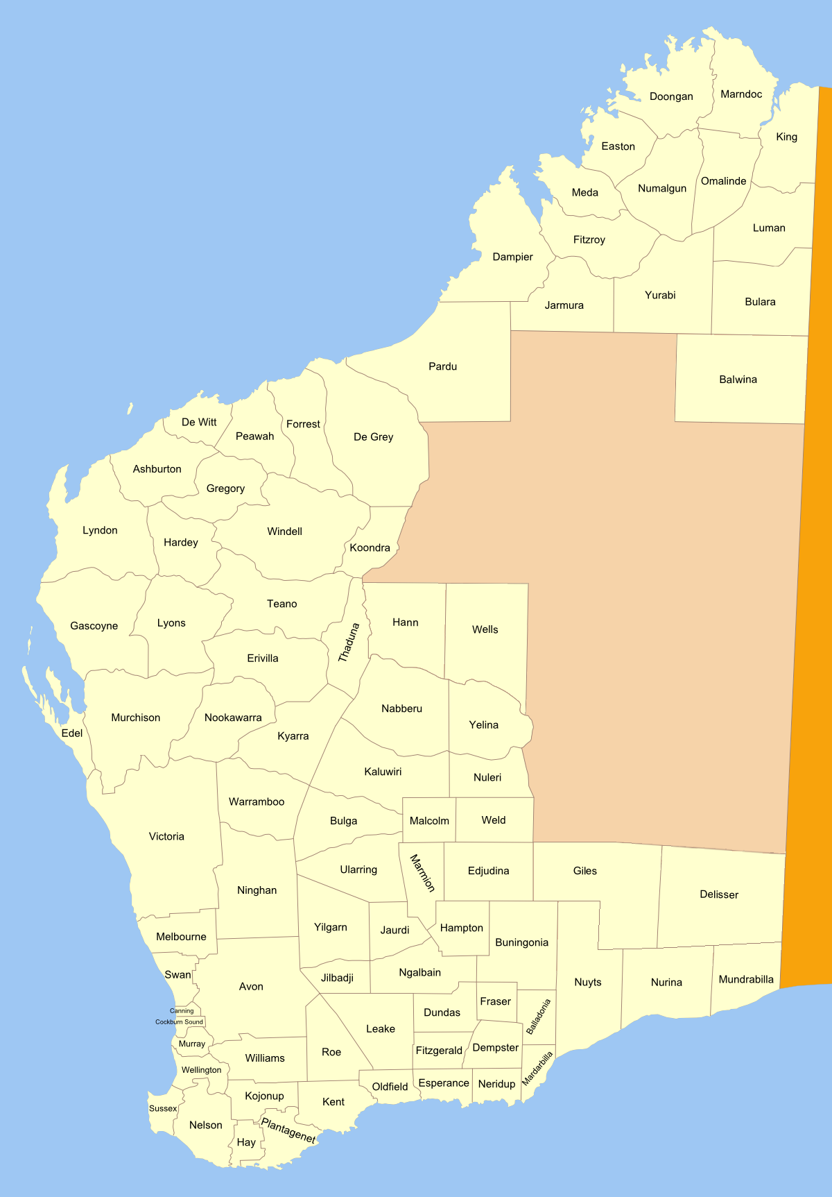
Map of land districts in Western Australia, as shown on old public domain 1909 map at the National Library. made from original svg
See also: blank map for making locator maps
[edit] Licensing

File history
Click on a date/time to view the file as it appeared at that time.
| Date/Time | Dimensions | User | Comment | |
|---|---|---|---|---|
| current | 00:31, 17 March 2007 | 1,200×1,725 (292 KB) | Roke | (Map of land districts in Western Australia, as shown on old public domain [http://nla.gov.au/nla.map-db87 1909 map] at the National Library Category:Cadastral maps of Western Australia) |
File links
The following pages on the English Wikipedia link to this file (pages on other projects are not listed):

