Image:MNGeolRegions.GIF
From Wikipedia, the free encyclopedia
Size of this preview: 480 × 600 pixels
Full resolution (1,200 × 1,500 pixels, file size: 669 KB, MIME type: image/gif)
| | This is a file from the Wikimedia Commons. The description on its description page there is shown below.
|
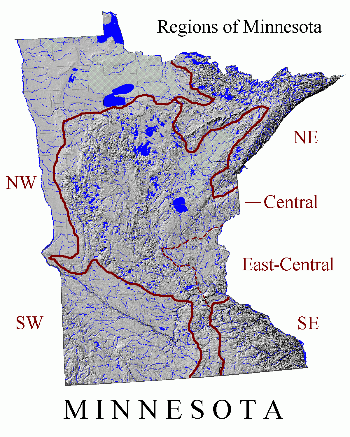
Shaded relief image of Minnesota in central North America, from National Atlas Mapmaker [1], modified to show generalized view of geologic regions, after Sansome, Constance J. (1983) Minnesota Underfoot: A Field Guide to the State's Outstanding Geologic Features, Stillwater, MN: Voyageur Press, ISBN 0-8965-8036-9; and (with respect to northern boundary of Southwest Minnesota) Ojakangas, Richard R. and Matsch, Charles L. (1982) Minnesota's Geology, Minneapolis, MN: University of Minnesota Press, ISBN 0-8166-0953-5. As to modifications, submitter releases all rights and specifically licenses use of this image under en:GNU Free Documentation License.
[edit] Licensing
| This work is in the public domain in the United States because it is a work of the United States Federal Government under the terms of Title 17, Chapter 1, Section 105 of the US Code. See Copyright.
Note: This only applies to works of the Federal Government and not to the work of any individual U.S. state, territory, commonwealth, county, municipality, or any other subdivision. العربية | Български | Česky | Deutsch | English | Español | Français | Magyar | Italiano | 日本語 | 한국어 | Polski | Português | 中文(繁體) | 中文(简体) | +/- |
 |
File history
Click on a date/time to view the file as it appeared at that time.
| Date/Time | Dimensions | User | Comment | |
|---|---|---|---|---|
| current | 03:22, 30 June 2007 | 1,200×1,500 (669 KB) | Kablammo | (Shaded relief image of Minnesota in central North America, from National Atlas Mapmaker [http://www.nationalatlas.gov/natlas/Natlasstart.asp], modified to show generalized view of geologic regions, after Sansome, Co) |
File links
- User:Ottergoose
- User:The shaggy one
- User:Utilitaritron
- User:It's-is-not-a-genitive/previous
- User:Davumaya
- User:Alcarinquë
- User:Station Attendant
- User:SpacemanAfrica
- User:LindaMorman
- User:Wyatt Riot
- User:Jmaynard
- User:Sterichinderance
- User:Smarterthanu91
- User:G00b3r
- User:Ethethlay
- User:Mitchoyoshitaka
- User:Classicjazzbari
- User:Stoli
- User:ChristTrekker
- User:Mientkiewicz5508
- User:DaNASCAT/Userboxen
- User:Bschott/Userboxes
- User:Wotnarg
- User:Afalbrig
- User:Markovich292
- User:Stranger-in-the-future
- User:Michaelellwood
- User:Maestro tomas
- Geology of Minnesota
- User:UBX/Userboxes/Non-ISO Languages
- User:Nathanm mn
- User:Mamyles
- User:Shatteredshards
- User:IwillPAWNu
- User:Panzerlied
- User:Comperr/userboxes
- User:Dr. Hannibal Lecter
- User:Blueminneapolis
- User:Brain Rodeo
- User:Sable232/User en-us-mn
- User:It's-is-not-a-genitive/IE
- User:Aeroplane
- User:Voot42
- User:It's-is-not-a-genitive
- User:Christy747/ubx
- User:CheeseGamer
- User:Sable232

