Image:Map.Dindigul District.Tamilnadu.AMS.jpg
From Wikipedia, the free encyclopedia

Size of this preview: 785 × 600 pixels
Full resolution (5,000 × 3,819 pixels, file size: 4.66 MB, MIME type: image/jpeg)
| | This is a file from the Wikimedia Commons. The description on its description page there is shown below.
|
[edit] Summary
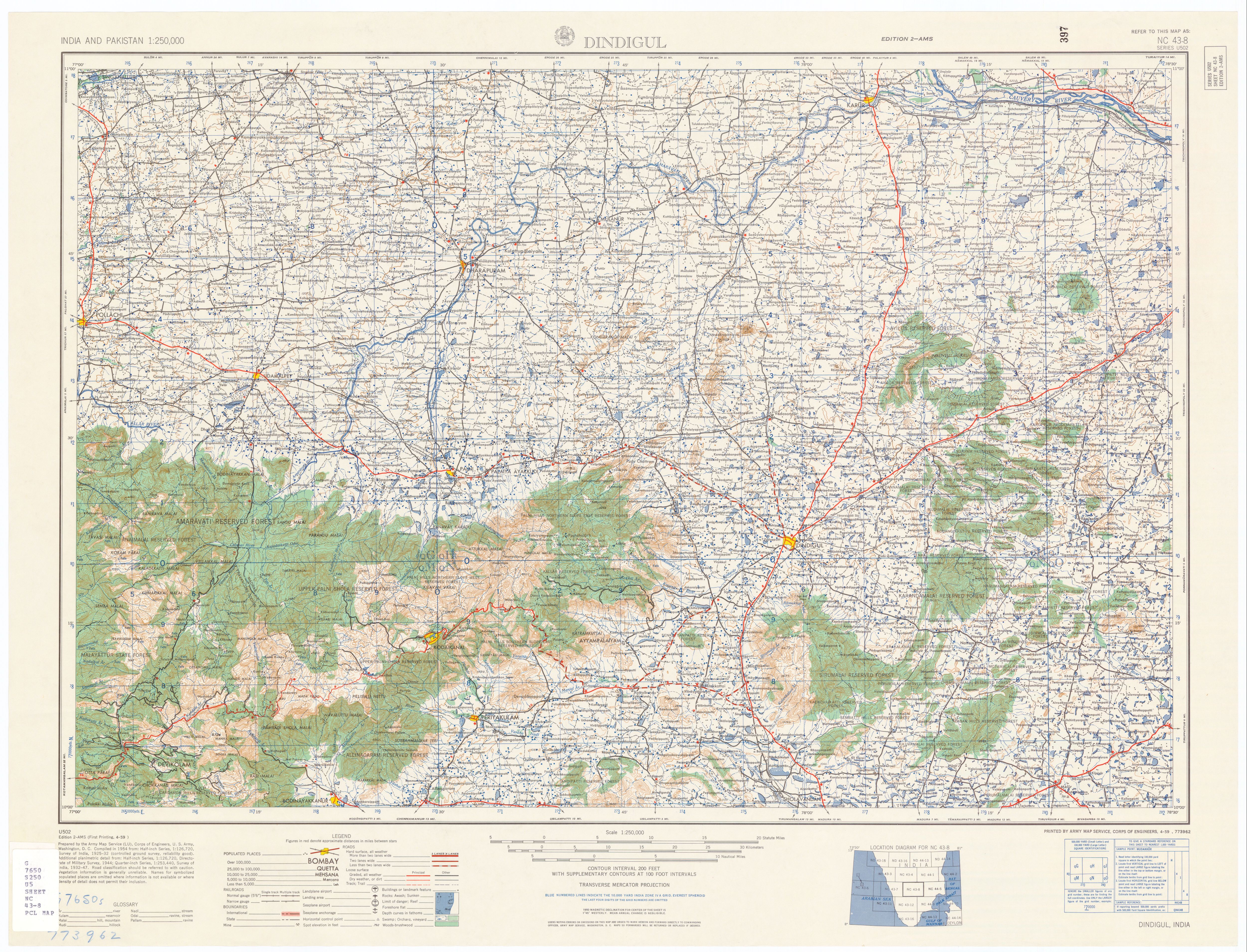
| Description |
Dingigul District,Tamil Nadu, India |
|---|---|
| Source |
U.S. Army Topology Command |
| Date |
1955 |
| Author |
U.S. Army Map Service |
| Permission (Reusing this image) |
Public Domain |
| Other versions | http://www.lib.utexas.edu/maps/ams/india/nc-43-08.jpg |
[edit] Licensing
| This work is in the public domain in the United States because it is a work of the United States Federal Government under the terms of Title 17, Chapter 1, Section 105 of the US Code. See Copyright.
Note: This only applies to works of the Federal Government and not to the work of any individual U.S. state, territory, commonwealth, county, municipality, or any other subdivision. العربية | Български | Česky | Deutsch | English | Español | Français | Magyar | Italiano | 日本語 | 한국어 | Polski | Português | 中文(繁體) | 中文(简体) | +/- |
 |
File history
Click on a date/time to view the file as it appeared at that time.
| Date/Time | Dimensions | User | Comment | |
|---|---|---|---|---|
| current | 06:23, 26 January 2007 | 5,000×3,819 (4.66 MB) | Marcus334 | ({{Information |Description=Dingigul District,Tamil Nadu, India |Source=U.S. Army Topology Command |Date=1955 |Author=U.S. Army Map Service |Permission=Public Domain |other_versions= http://www.lib.utexas.edu/maps/ams/india/nc-43-08.jpg |all other district) |
File links
The following pages on the English Wikipedia link to this file (pages on other projects are not listed):

