Image:Lancashire outline map with UK.png
From Wikipedia, the free encyclopedia
Size of this preview: 504 × 600 pixels
Full resolution (600 × 714 pixels, file size: 423 KB, MIME type: image/png)
| | This is a file from the Wikimedia Commons. The description on its description page there is shown below.
|
[edit] Summary
| Description |
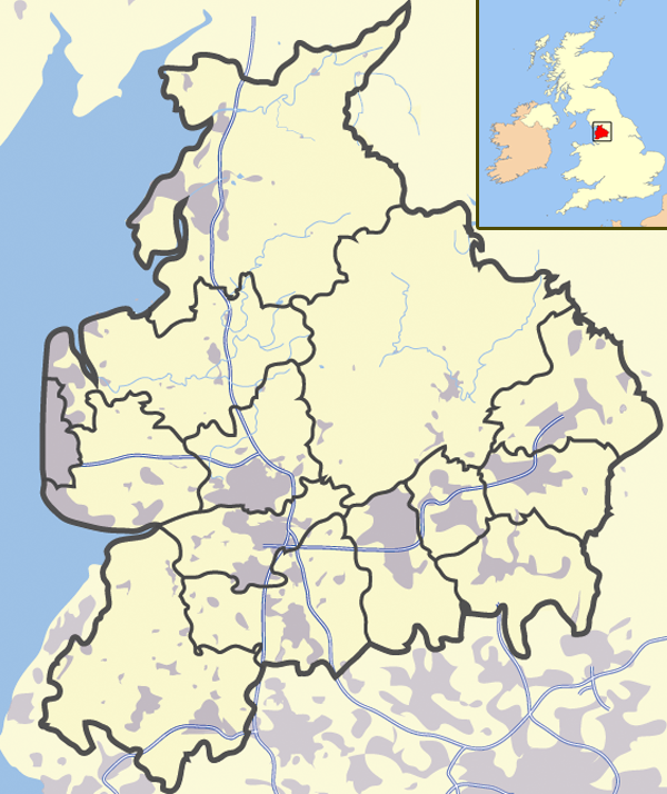
A map of Lancashire, in North West England |
|---|---|
| Source |
self-made |
| Date |
19-06-2007 |
| Author | |
| Permission (Reusing this image) |
see below |
[edit] Licensing
| I, Jhamez84, the copyright holder of this work, hereby release it into the public domain. This applies worldwide. In case this is not legally possible: Afrikaans | Alemannisch | Aragonés | العربية | Asturianu | Български | Català | Česky | Cymraeg | Dansk | Deutsch | Eʋegbe | Ελληνικά | English | Español | Esperanto | Euskara | Estremeñu | فارسی | Français | Galego | 한국어 | हिन्दी | Hrvatski | Ido | Bahasa Indonesia | Íslenska | Italiano | עברית | Kurdî / كوردی | Latina | Lietuvių | Latviešu | Magyar | Македонски | Bahasa Melayu | Nederlands | Norsk (bokmål) | Norsk (nynorsk) | 日本語 | Polski | Português | Ripoarisch | Română | Русский | Shqip | Slovenčina | Slovenščina | Српски / Srpski | Svenska | ไทย | Tagalog | Türkçe | Українська | Tiếng Việt | Walon | 中文(简体) | 中文(繁體) | zh-yue-hant | +/- |
File history
Click on a date/time to view the file as it appeared at that time.
| Date/Time | Dimensions | User | Comment | |
|---|---|---|---|---|
| current | 13:59, 26 March 2008 | 600×714 (423 KB) | Jhamez84 | (Reverted to version as of 20:12, 21 June 2007) |
| 13:56, 26 March 2008 | 600×714 (448 KB) | Jhamez84 | (Reverted to version as of 20:32, 19 June 2007) | |
| 20:12, 21 June 2007 | 600×714 (423 KB) | Jhamez84 | (making some corrections) | |
| 20:32, 19 June 2007 | 600×714 (448 KB) | Jhamez84 | ({{Information |Description= A map of Lancashire, in Jhamez84 }} ) |
File links
- Accrington
- Bacup
- Lancaster, Lancashire
- Chorley
- Read, Lancashire
- Ormskirk
- Burnley
- Galgate
- Heysham
- Blackburn
- Barnoldswick
- Darwen
- Clitheroe
- Parbold
- Adlington, Lancashire
- Kirkham, Lancashire
- Lytham St Annes
- Longridge
- Poulton-le-Fylde
- Carnforth
- Reedley, Lancashire
- Upholland
- Padiham
- Clayton-le-Moors
- Skelmersdale
- Brierfield
- Oswaldtwistle
- Fleetwood
- Whalley, Lancashire
- Cleveleys
- Stonyhurst
- Bolton-le-Sands
- Haslingden
- River Wyre
- Church of St. Walburge, Preston
- Higham, Lancashire
- Nelson, Lancashire
- Colne
- Wycoller
- Knott End-on-Sea
- List of places in Lancashire
- Trawden
- Coppull
- Burscough
- Great Harwood
- Royal Lytham & St Annes Golf Club
- Ribchester
- Brownhill
- Thornton, Lancashire
- Catforth
- Wilpshire
- Silverdale, Lancashire
- Euxton
- Goosnargh
- Melling, Lancashire
- Bay Horse
- Langho
- Cockerham
- Walton-le-Dale
- Longton, Lancashire
- Halton, Lancashire
- Rossendale Valley
- Edenfield
- Rawtenstall
- Anglezarke
- Lathom
- Eccleston, Lancashire
- Haskayne
- Tarleton
- Farington
- Wrea Green
- Grimsargh
- Freckleton
- Glasson Dock
- Lostock Hall
- Newton-in-Bowland, Lancashire
- Abbey Village
- Abbeystead
- Clayton-le-Woods
- Rufford, Lancashire
- Belmont, Lancashire
- Bamber Bridge
- Penwortham
- Dunsop Bridge
- Earby
- Whitworth, Lancashire
- Blacko
- Clayton Brook
- Croston
- Whittle-le-Woods
- Buckshaw Village
- Altham, Lancashire
- Anderton, Lancashire
- Quernmore
- Arkholme
- Astley Village
- Aughton, Lancashire
- Balderstone
- Barrowford
- Bickerstaffe
View more links to this file.

