Knighton, Powys
From Wikipedia, the free encyclopedia
| Knighton | |
 Knighton shown within the United Kingdom |
|
| Population | 3,901 |
|---|---|
| OS grid reference | |
| Principal area | Powys |
| Ceremonial county | Powys |
| Constituent country | Wales |
| Sovereign state | United Kingdom |
| Post town | KNIGHTON |
| Postcode district | LD7 |
| Dialling code | 01547 |
| Police | Dyfed-Powys |
| Fire | Mid and West Wales |
| Ambulance | Welsh |
| European Parliament | Wales |
| UK Parliament | Brecon & Radnorshire |
| List of places: UK • Wales • | |
Knighton (pronounced //naɪtɒn//) (Welsh: Trefyclawdd or Trefyclo) is a small town situated chiefly in Powys, Wales. Lying on the River Teme, the town straddles the English-Welsh border; Knighton railway station, as well as a small part of the town's built-up area, lie in Shropshire, England.
Contents |
[edit] History
- See also: Offa's Dyke
- See also: Radnorshire
The name Knighton probably derives from the Old English words cniht and tūn meaning, respectively, ". . . a soldier, personal follower, young man, servant, thane, freeman" and ". . . farm, settlement, homestead". This implies that the settlement was perhaps founded as the result of a grant of land to freemen[1]. By contrast the Welsh name (Tref-y-Clawdd) is more straightforward and translates simply as the town on the dyke.[2]
Inevitably, Knighton's earliest history is obscure but there are local clues: Caer Caradoc (an Iron Age hillfort associated with Caradoc or Caractacus) is 2 miles (3 km) away and just off the road towards Clun.[3] Watling Street, a Roman road, passes a few miles to the east at Leintwardine. Knighton is known for a well preserved section of Offa's Dyke.[4]. Intriguingly, Wat's Dyke also runs parallel to Offa's Dyke and a few miles to the east. An earthwork that runs north-south along the English/Welsh border from Basingwerk near Holywell to Oswestry.[5] The dykes aside, two Norman castles, constructed in the 12th century, are the oldest survivals in modern Knighton[6] The town became a borough in 1203, with a charter permitting a weekly market and annual fair.[7] The castle was besieged by Owain Glyndŵr in 1402 and the castle and much of the town were destroyed.[8] The major battle of the rebellion was fought at Pilleth (Welsh: Bryn Glas) 3 miles (5 km) south of the town in the same year.
The town’s church dates from the 11th century, but much of it was rebuilt in the 19th century. It is one of only two in Wales dedicated to St Edward; the patron saint of England before St George.[7]. This dedication to an English saint is a symptom of a dual English/Welsh nature of the town that was not legally resolved until 1535 when Knighton was finally confirmed as part of Wales by the Acts of Union[6].
Knighton first prospered as a centre of the wool trade in the 15th century, and was later an important point on the two drover routes from Montgomery to Hereford, and from London to Aberystwyth. Otherwise, Knighton was remote from the centres of commerce. It seemed likely that the railway revolution would also fail to reach the town; the 1840s and 1850s saw considerable railway building right across Great Britain but Radnorshire had a small population and little industry. The construction of the railway was made economically viable - just - by an entrepreneurial driveto connect the Mumbles and Milford Haven with the cities and factories of the industrial Midlands.[9] The Knighton Railway company was formed by local landowners and businessmen to build a line from Craven Arms to the town.[10][11] Work began in August 1858 and the line reached Knighton in March 1861. The station itself was built in 1865.[11] To mark the accession of H.M. Queen Elizabeth II in 1953 the initials "ER" were planted out in deciduous trees within an evergreen forest on the hill to the north of the town.[12]
In August 1970, Knighton hosted a rock festival with bands such as, The Move and the somewhat more obscure Pete Brown & Piblokto, Roger Bunn, Forever More, Clark-Hutchinson, James Litherland’s Brotherhood (James was originally part of Colosseum) and Killing Floor. Comperes were radio DJ Pete Drummond and local resident and bluesman Alexis Korner, who also performed.[13]
[edit] Governance
- See also: Politics of Wales

After the Acts of Union, Knighton was for nearly 450 years part of the traditional County of Radnorshire. In common with many ancient counties it ceased to exist in 1974 and was subsumed in the county of Powys.
The town council of 13 councillors elects a largely ceremonial mayor.[14] The mayor for 2008 is Ken Fincham.[15] Real municipal authority lies with Powys County Council. Above the county council, the National Assembly for Wales forms the next tier of government.
Knighton falls within the Westminster constituency of Brecon & Radnor and the current MP is Roger Williams - a Welsh Liberal Democrat. The Principality forms one large Wales European Parliamentary constituency. It is part of the National Assembly for Wales constituency of Brecon and Radnorshire and represented by Kirsty Williams AM; she is also a Welsh Liberal Democrat. The town returns a single councillor to Powys County Council; currently Mr K Harris(2008)[11].
Knighton has a fire station served by a part-time crew and part of the Mid and West Wales Fire and Rescue Service. Knighton’s police station is also part-time; the local force is Dyfed-Powys Police.
Knighton has a hospital on Ffrydd Road on the site of and using some of the former buildings of the Workhouse. It has maternity facilities but no accident and emergency capacity. Primary care is provided by two GP practices and a pharmacy.[16]
Social housing is largely provided by two housing associations; one based in Wales (Mid Wales Housing Association) and another in England (South Shropshire Housing Association).[17][18]
[edit] Demography
- See also: Demography of Wales
| Religion | %[19] |
|---|---|
| Buddhist | 0.13 |
| Christian | 74.33 |
| Hindu | 0.00 |
| Jewish | 0.00 |
| Muslim | 0.13 |
| No religion | 16.14 |
| Other | 0.32 |
| Sikh | 0.00 |
| Not stated | 8.91 |
| Age | Percentage[20] |
|---|---|
| 0–15 | 20.57 |
| 16+17 | 2.60 |
| 18–44 | 30.47 |
| 45–59 | 20.97 |
| 60–84 | 43.87 |
| 85+ | 2.50 |
| Year | Population:[21][22][11] |
|---|---|
| 1841 | 1,404 |
| 1851 | 1,566 |
| 1861 | 1,853 |
| 1871 | 1,946 |
| 1881 | 1,905 |
| 1891 | 1,813 |
| 1901 | 2,139 |
| 2001 | 3,043 |
| 2005 | 3,901 |
| Knighton Compared | |||
|---|---|---|---|
| 2001 UK Census | Knighton | Powys | Wales |
| Total population | 3,043 | 126,354 | 2,903,000 |
| Speaks and or reads Welsh | 15.85% | 29.16% | 28.4% |
| Non-white | 0.10% | 0.10% | 2.00% |
| Born in Wales | 38.35% | 97.00% | 75.00% |
| Welsh ethnicity (self-declared) | 3.00% | 14.00% | 14.00% |
| Unemployed | 2.88% | 4.12% | 3.30% |
| No qualifications | 33.63% | 22.60% | 23.61% |
Dry statistics that confirm Knighton's slow growth since the early nineteenth century. The 2001 Census provides a snapshot of Knighton today and compared with the county and principality as a whole.[23][11] Knighton is not as Welsh as the rest of the Principality, less diverse and more poorly educated but nonetheless experiences higher rates of employment.[24]
[edit] Culture
[edit] Attractions

On the last Saturday in August the town holds its annual Carnival and Show, which attracts thousands of visitors to the town from all over the world.[25] It features two parades one at midday and another at around 8 pm; these consist of various themed carnival floats and people dressed in fancy dress. The show takes place at the town's showground at Bryn-y-Castell; also home to Knighton Town F.C., Knighton Cricket Club and Knighton Hockey Club.
Within the town are the visible remains of two early castle mottes.[26] One at Bryn-y-Castell and the other hidden behind the fire station and in a private garden.[27]
Just outside Knighton and visible for many miles, is an observatory with a telescope, Europe's largest camera obscura and a planetarium. The observatory is part of the Spaceguard UK[28] project which searches for asteroids that might threaten the earth.
The Clock Tower – similar to those in Rhayader, Hay on Wye and Machynlleth – built in 1872 is a central landmark[29][30] and visible in the picture above.
Knighton is at the centre or the start of 2 National Trails; Glyndwr's Way and Offa's Dyke Path. The Offa's Dyke Association has a visitors' centre in the town alongside the site of the ceremony at which John Hunt, Baron Hunt of Llanfair Waterdine inaugurated the long distance footpath in 1971.[31] It is a walk recommended by the Daily Telegraph.[32] A further trail – the Jack Mytton Way – passes nearby and yet another – Wat's Dyke Way – is proposed.[33]
[edit] Cultural References
Knighton has served as a location for two major films. First, Gone to Earth (released 1950) and directed by Michael Powell and Emeric Pressburger used the nearby location of Pentre, New Invention.[34][35]. Second Best (released 1994) and starring, William Hurt was filmed, in part, in Knighton[36].
The Oscar winning actress Julie Christie lived nearby in the 1970s.[37] The less notable actor Richard Thorp, best known as the tubby publican Alan Turner in Emmerdale, lives at Skyborry.[38]
Knighton is mentioned in A Shropshire Lad by A E Houseman:[39]
| “ | We still had sorrows to lighten, One could not always be glad, |
” |
Of perhaps less literary note, Guy N Smith's book The Knighton Vampires is based locally.[40]
The musician, songwriter, historian, and broadcaster Alexis Korner also lived nearby in the 1970s. Finally, the writer Roy Kerridge often stayed in the town because it was cheap.[41]
[edit] Sport

In common with many small towns, Knighton has rugby, football and hockey teams.[42][43] It also has a 9-hole Golf course established in 1906, and designed by Harry Vardon.[44][45]
The football club plays in the Mid Wales League and Aspidistra Radnorshire Cup. The footballer Arthur Rowley – brother of England international Jack – managed the town's football team.[46]
For recreational sportsmen and women a swimming pool and leisure centre are available.[47][48]
[edit] Notable residents
Knighton has failed to generate many indigenous people of real historic note but many, such as Julie Christie, have been seduced by its rural charm. The famous few include the saxophonist and composer Dick Heckstall-Smith, who was raised near the town.[49] Also, Commodore Paul Webb, one of three Spitfire pilots who took part in the shooting down of the first German aircraft attacking a target on British soil during World War II.[50] Emma Watkins, wife of David Manners, 11th Duke of Rutland and chatelaine of Belvoir Castle, was born and raised locally. Finally, Sir Simon Gourlay former President of the NFU farms locally.[51][52]
[edit] Economy
The town has a variety of shops serving a large rural hinterland and employing 18% of the active population and – after manufacturing (18.81%) – the largest single employment sector.[53] Otherwise, and in common with many small towns, Knighton has little industry.[54] Most young people leave after completing their education. Tourism is crucial and, consequently, the area was hit hard by the Foot and Mouth epidemic of 2001.[55]
Although wages are low (e.g. 20%+ of homes have no car[11]) Knighton has an unemployment rate (2001) of just 2.88%.[11]
Responsibility for economic development lies with the Welsh Assembly Government. Knighton remoteness makes it an unilikely choice for the commuter and, consequently, the majority of the working population (69.45% in 2001) work within a 12 miles (19 km) Travel to Work Area.[56]
[edit] Education
- See also: Education in Wales
Knighton has a primary school[57] but for state secondary education, pupils are bussed 8 miles (13 km) to John Beddoes School in Presteigne. Until 1974 Knighton had a secondary modern school, on the site of the current primary school.[58]
Knighton Church in Wales Primary school has 287 pupils (2002) and in the most recent Estyn inspection was graded Good or Satisfactory; the inspectors were largely positive but criticised "low expectations".[59]
[edit] Geography

[edit] Location
Knighton is 137 miles (220 km) from the UK capital city, London; 86 miles (138 km) from the Welsh capital of Cardiff; and, 19 miles (31 km) from the county town, Llandrindod Wells.[60]
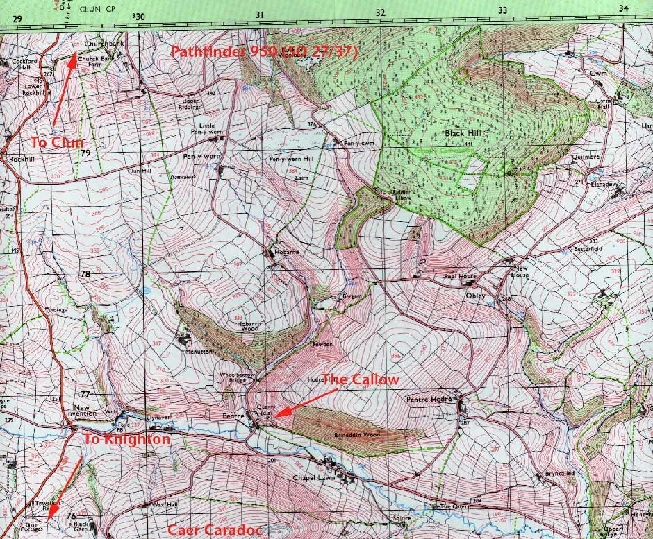
The town is remote but is connected with the following towns and villages.
 |
|
||||||
 |
|||||||
Knighton is a nucleated settlement centred on the clock tower with limited ribbon development along the A roads.
[edit] Geology and geomorphology

Knighton is at at . It is in a sparsely populated tract of mid-Wales characterised by a hilly plateau cut by narrow river-valleys with a broadly east-west axis. To the west, ground rises steeply towards Radnor Forest, and to the north, more gently, to the summit of Clun Forest. Turning east, the elevation falls gently to the Shropshire Plain. To the south of the town stands Llan Wen hill.
The town centre lies at circa 174 metres above sea level although the surrounding hills - Bailey Hill the highest - rise to 418 metres above sea level. The only major river is the River Teme.
It is difficult to improve on the words of Samuel Lewis (a mid 19th century visitor):
| “ | . . . .at the head of a deep vale sheltered on all sides by hills of lofty elevation, crowned with timber of luxuriant growth, and commanding extensive and finely varied prospects over the surrounding country |
” |
Knighton rests on Ludlovian rocks of the Silurian period and is at what was the southernmost edge of the ice-sheet during the last ice age.[62]
[edit] Climate
The average temperature and rainfall figures taken between 1971 and 2000 at the Met Office weather station in Shawbury, are set out in the table below. Although 35 miles (56 km) away, Shawbury is the nearest recording station and has a similar climate. Knighton is in the rain shadow of the Cambrian Mountains and consequently is slightly warmer and substantially drier than the Wales average.[63]
| Weather averages for Shawbury Weather Station, Shawbury, Shropshire, England | |||||||||||||
|---|---|---|---|---|---|---|---|---|---|---|---|---|---|
| Month | Jan | Feb | Mar | Apr | May | Jun | Jul | Aug | Sep | Oct | Nov | Dec | Year |
| Average high °C (°F) | 6.5 (44) | 6.6 (44) | 9.2 (49) | 11.9 (53) | 15.5 (60) | 18.5 (65) | 20.3 (69) | 20.0 (68) | 17.5 (64) | 13.9 (57) | 9.4 (49) | 7.3 (45) | 13.1 (56) |
| Average low °C (°F) | 0.3 (33) | 0.2 (32) | 1.5 (35) | 3.1 (38) | 6.0 (43) | 8.9 (48) | 10.9 (52) | 10.6 (51) | 8.6 (47) | 6.1 (43) | 2.6 (37) | 1.0 (34) | 5.0 (41) |
| Precipitation mm (inches) | 54.8 (2.2) | 41.9 (1.6) | 49.3 (1.9) | 46.9 (1.8) | 56.5 (2.2) | 53.9 (2.1) | 52.9 (2.1) | 58.2 (2.3) | 58.0 (2.3) | 55.8 (2.2) | 62.0 (2.4) | 62.9 (2.5) | 653.2 (25.7) |
| Source: Met Office[64] 2008-01-09 | |||||||||||||
On 18 August 2004, fish fell from the sky in one of the most recent instances of raining animals within the United Kingdom.[65]
[edit] Transport
Knighton is approximately 30 miles (48 km) west of the larger towns and cities of Shrewsbury and Hereford and at the junction of the A4113 road and the A488 road.
Local bus services are very limited and heavily subsidised[66][67] but Knighton is fortunate to have a railway station on the Heart of Wales Line which puts the town within 4 hours of London, 2–3 hours of Cardiff and just 1 hour from Shrewsbury.
The nearest international airport is at Birmingham. Light aircraft can fly from Welshpool Airport and Shobdon Aerodrome.
The River Teme in its higher reaches is not navigable.
[edit] References
- ^ Ancestry.co.uk. Retrieved on 11 March 2008.
- ^ InterTran. Retrieved on 11 March 2008.
- ^ The National Gazetteer of Great Britain and Ireland (1868). Retrieved on 19 February 2007.
- ^ William Camden. Chorographicall Description of the most flourishing Kingdomes, England, Scotland, and Ireland (London, 1610). Retrieved on 19 February 2007.
- ^ InfoPlease. Retrieved on 11 March 2008.
- ^ a b Knighton On Line. Retrieved on 19 February 2007.
- ^ a b Clwyd Powys Archaeological Trust. Retrieved on 19 February 2007.
- ^ Christopher Catling, Ronnie Catling. Glyndwr's Way: A Welsh National Trail. Retrieved on 19 February 2007.
- ^ Powys Digital History Project. Retrieved on 11 March 2008.
- ^ Seal of the Knighton Railway company. Retrieved on 20 November 2007.
- ^ a b c d e f g Powys County Council - transport in Knighton and district. Retrieved on 20 November 2007.
- ^ Go2 Shropshire. Retrieved on 20 November 2007.
- ^ Marmalade Skies - original poster of the Knighton Concert. Retrieved on 20 November 2007.
- ^ Knighton Town Council. Retrieved on 23 January 2008.
- ^ Knighton Town Council. Retrieved on 23 January 2008.
- ^ BBC Wales microsite. Retrieved on 23 January 2008.
- ^ Welsh Audit Office Report on Mid-Wales HA Wales. Retrieved on 01 February 2008.
- ^ South Shropshire HA. Retrieved on 01 February 2008.
- ^ Key Figures for 2001 Census: Key Statistics. Office for National Statistics (2001). Retrieved on 2007-12-16.
- ^ Key Figures for 2001 Census: Key Statistics. Office for National Statistics (2001). Retrieved on 2007-12-16.
- ^ Samuel Lewis. Genuki - A Topographical Dictionary of Wales. Retrieved on 20 November 2007.
- ^ Powys Digital History Project. Retrieved on 20 November 2007.
- ^ Welsh Language Board. Retrieved on 20 November 2007.
- ^ Neighbourhodd Statistics. Retrieved on 20 November 2007.
- ^ BBC – comments on the carnival Project. Retrieved on 11 March 2008.
- ^ Castle Wales. Retrieved on 20 November 2007.
- ^ Castle Wales. Retrieved on 20 November 2007.
- ^ SpaceGuard UK. Retrieved on 20 November 2007.
- ^ BBC News - mid Wales. Retrieved on 02 February 2008.
- ^ Knighton On Line. Retrieved on 19 February 2007.
- ^ Offa's Dyke Association. Retrieved on 17 December 2007.
- ^ Daily Telegraph. Retrieved on 20 November 2007.
- ^ BBC Website. Retrieved on 17 December 2007.
- ^ IMDB. Retrieved on 20 November 2007.
- ^ Emeric & Pressburger Fan Site. Retrieved on 20 November 2007.
- ^ IMDB. Retrieved on 20 November 2007.
- ^ the Guardian - ". . . lived in rural Wales". Retrieved on 20 November 2007.
- ^ Hereford Times. Retrieved on 17 December 2007.
- ^ Teme Valley. Retrieved on 18 February 2008.
- ^ Fantastic Fiction. Retrieved on 18 February 2008.
- ^ Daily Telegraph. Retrieved on 20 November 2007.
- ^ BBC Website. Retrieved on 23 January 2008.
- ^ Powys County Council, Hockey. Retrieved on 01 February 2008.
- ^ Knighton GC. Retrieved on 01 February 2008.
- ^ Knighton GC website. Retrieved on 01 February 2008.
- ^ Daily Telegraph - Obituary. Retrieved on 20 November 2007.
- ^ Knighton GC. Retrieved on 01 Feb 2008.
- ^ Powys County Council - Leisure Centre. Retrieved on 01 February 2008.
- ^ Daily Telegraph. Retrieved on 20 November 2007.
- ^ Daily Telegraph - Obituary. Retrieved on 20 November 2007.
- ^ Radnorshire Planning - including address of Sir Simon Gourlay. Retrieved on 20 November 2007.
- ^ Better Regulation Taskforce - Bio of Sir Simon Gourlay. Retrieved on 20 November 2007.
- ^ Powys County Council. Retrieved on 20 November 2007.
- ^ Applegate - list of Knighton employers. Retrieved on 20 November 2007.
- ^ BBC - Knighton minisite. Retrieved on 20 November 2007.
- ^ National Statistics. Retrieved on 11 March 2008.
- ^ Primary School. Retrieved on 01 February 2008.
- ^ Archives Network Wales. Retrieved on 01 February 2008.
- ^ Lona Thomas. [http://www.estyn.gov.uk/inspection_reports/KnightonE.pdf accessdaymonth=01 February Estyn Report Wales].
- ^ Google mapping. Retrieved on 11 March 2008.
- ^ Samuel Lewis. Killymaenllwyd - Knighton - A Topographical Dictionary of Wales (1849). Retrieved on 19 February 2007.
- ^ Shropshire Geology. Retrieved on 20 November 2007.
- ^ Met Office average weather statistics for Wales 1971 to 2000
- ^ Met Office Shawbury 1971-2000 averages. UK government. Retrieved on Jan 9, 2008.
- ^ BBC - local news report. Retrieved on 20 November 2007.
- ^ Hereford Bus. Retrieved on 01 February 2008.
- ^ Sargeant Bros Bus. Retrieved on 01 February 2008.
[edit] External links
- The town in Victorian times
- Local Chamber of Trade
- Offa's Dyke Association
- BBC local page
- Aerial photograph of Knighton looking West - East
- Pictures of Knighton on Geograph
|
|||||||||||||||||||||||

