Image:Craigellachie BC Canada Location.png
From Wikipedia, the free encyclopedia
No higher resolution available.
Craigellachie_BC_Canada_Location.png (246 × 187 pixels, file size: 5 KB, MIME type: image/png)
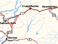
Map showing location of Craigellachie, BC, Canada
 |
Permission is granted to copy, distribute and/or modify this document under the terms of the GNU Free Documentation License, Version 1.2 or any later version published by the Free Software Foundation; with no Invariant Sections, no Front-Cover Texts, and no Back-Cover Texts. |
Created by User:al guy on August 13, 2004 and released under the GFDL. Colours are based on the discussions at Wikipedia talk:WikiProject Maps. Map drawn in GIMP. Underlying data © 2003. Government of Canada with permission from Natural Resources Canada and used under license
File history
Click on a date/time to view the file as it appeared at that time.
| Date/Time | Dimensions | User | Comment | |
|---|---|---|---|---|
| current | 05:13, 14 August 2004 | 246×187 (5 KB) | Al guy (Talk | contribs) | (Map showing location of Craigellachie, BC, Canada) |
- Search for duplicate files
- Edit this file using an external application
See the setup instructions for more information.
File links
The following pages on the English Wikipedia link to this file (pages on other projects are not listed):

