County Route 613 (Middlesex County, New Jersey)
From Wikipedia, the free encyclopedia
 |
|||||||||
| County Route 613 |
|||||||||
| Length: | 9.22 mi[1] (14.83 km) | ||||||||
|---|---|---|---|---|---|---|---|---|---|
| North end: | |||||||||
| Major junctions: |
|||||||||
| South end: | |||||||||
|
|||||||||
County Route 613 is a county route in Middlesex County, New Jersey that measures 9.22 miles in length. The road extends from the interchange at Route 18 and CR 535 in East Brunswick Township to the intersection of Tracy Station Road and CR 522 in Monroe Township. In the northern section of the roadway (from CR 617 to the NJ 18/CR 535 interchange), CR 613 is an avenue (consisting of two lanes in each direction). The rest of the roadway just consists of one lane in each direction. CR 613 runs concurrent with CR 615 in Spotswood for 0.42 miles. The northern end of the roadway has become more congested with new developments setting foot. Near the southern end of the roadway, more development has increased the vechicular volume.
Contents |
[edit] Route description

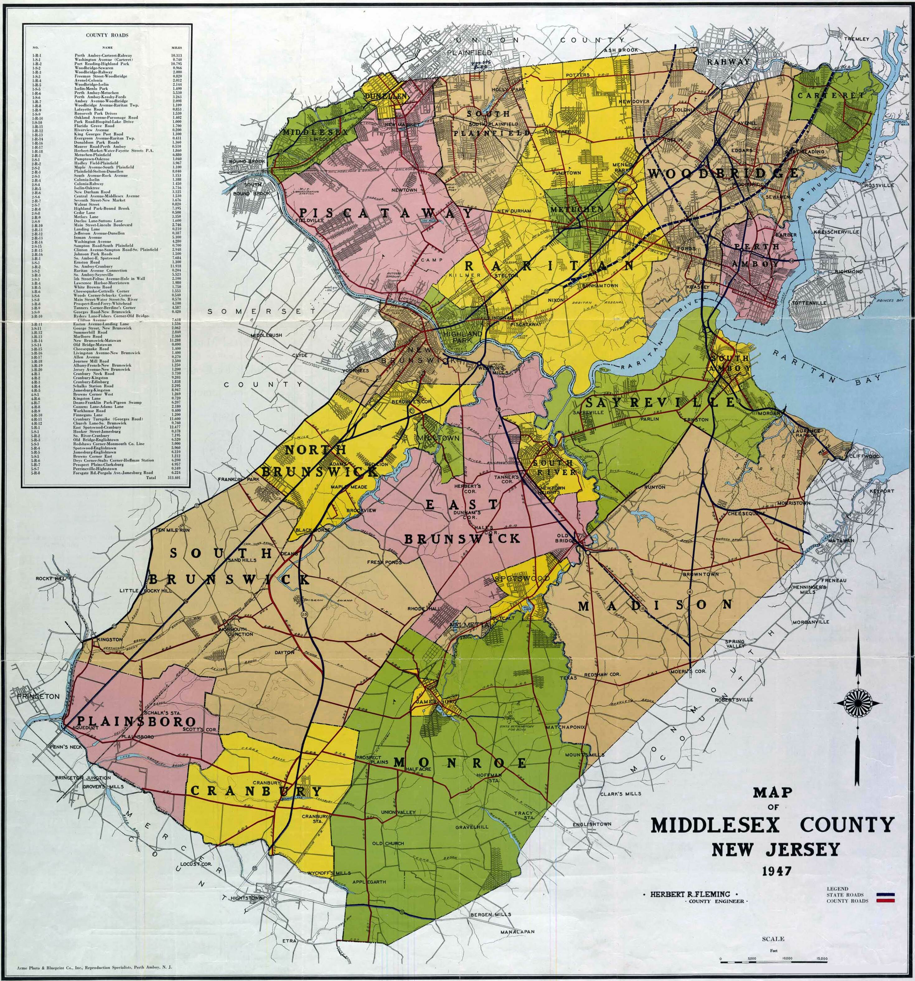
County Route 613 begins at a 4-way intersection with County Route 522 and Tracy Station Road in Monroe Township.[2] The road begins as Spotswood-Englishtown Road as it moves to the northeast. County Route 614, also known as Mounts Mills Road, intersects at 1.42 miles as 613 moves into Matchaponix, a borough of Monroe. County Route 612 and County Route 520 intersect at 3.41 miles as 613 enters Spotswood. Now known as Devoe Avenue, 613 merges into County Route 615 for .42 of a mile. 613 leaves to the left and enters downtown Spotswood as Summerhill Road. 613 continues into East Brunswick, where it intersects with County Route 617 at eight miles. 613 continues past the intersection and ends 1.22 miles later at County Route 535, near New Jersey Route 18.
[edit] History
Before the 600-series numbering system was introduced in Middlesex County, County Route 613's Summerhill Road portion was formerly known as County Route 3-R-12.[3] The rest of 613 was known as County Route 5-R-4.
[edit] Major intersections
| County | Location | Mile[1] | Roads intersected | Notes |
|---|---|---|---|---|
| Middlesex | Monroe Township | 0.00 | Southern terminus | |
| 3.41 | ||||
| Spotswood | 5.92 | Begin/end concurrency | ||
| 6.34 | Begin/end concurrency | |||
| East Brunswick | 8.00 | |||
| 9.22 |
[edit] See also
[edit] References
- ^ a b New Jersey Department of Transportation (2006). County Route 613 straight line diagram. New Jersey Department of Transportation. Retrieved on 2007-09-02.
- ^ Google Maps (2007). Middlesex County, NJ Route 613. Google. Retrieved on 2007-09-02.
- ^ Rutgers (1947). 1947 map of Middlesex County. Rutgers. Retrieved on 2007-09-02.

