Image:Yellowstone Caldera map2.jpg
From Wikipedia, the free encyclopedia
Size of this preview: 743 × 600 pixels
Full resolution (3,072 × 2,479 pixels, file size: 2.42 MB, MIME type: image/jpeg)
| | This is a file from the Wikimedia Commons. The description on its description page there is shown below.
|
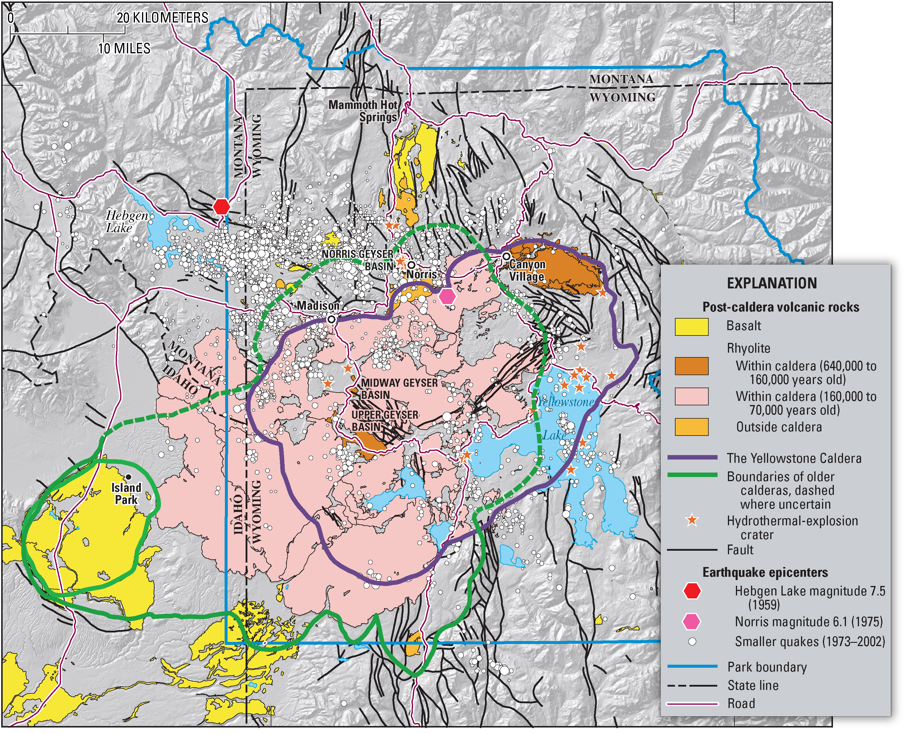
Geologic information regarding Yellowstone Caldera. From USGS. [1]
| This image is in the public domain because it contains materials that originally came from the United States Geological Survey, an agency of the United States Department of Interior. For more information, see the official USGS copyright policy |
|
File history
Click on a date/time to view the file as it appeared at that time.
| Date/Time | Dimensions | User | Comment | |
|---|---|---|---|---|
| current | 07:49, 16 February 2006 | 3,072×2,479 (2.42 MB) | Napa | (Geologic information regarding Yellowstone Caldera. From USGS. [http://pubs.usgs.gov/fs/2005/3024/press-images/fig_03_yellowstone_map.jpg] {{PD-USGov-Interior-USGS}} Category:Geography of the United States Category:Maps of the United States) |
File links
The following pages on the English Wikipedia link to this file (pages on other projects are not listed):
Metadata
This file contains additional information, probably added from the digital camera or scanner used to create or digitize it. If the file has been modified from its original state, some details may not fully reflect the modified file.
| Orientation | Normal |
|---|---|
| Horizontal resolution | 512 dpi |
| Vertical resolution | 512 dpi |
| Software used | Adobe Photoshop CS Macintosh |
| File change date and time | 09:51, 14 March 2005 |
| Color space | sRGB |


![[1]](http://pubs.usgs.gov/fs/2005/3024/press-images/fig_03_yellowstone_map.jpg)