Image:YaldingBeult0514.JPG
From Wikipedia, the free encyclopedia
Size of this preview: 800 × 600 pixels
Full resolution (2,016 × 1,512 pixels, file size: 749 KB, MIME type: image/jpeg)
| | This is a file from the Wikimedia Commons. The description on its description page there is shown below.
|
[edit] Summary
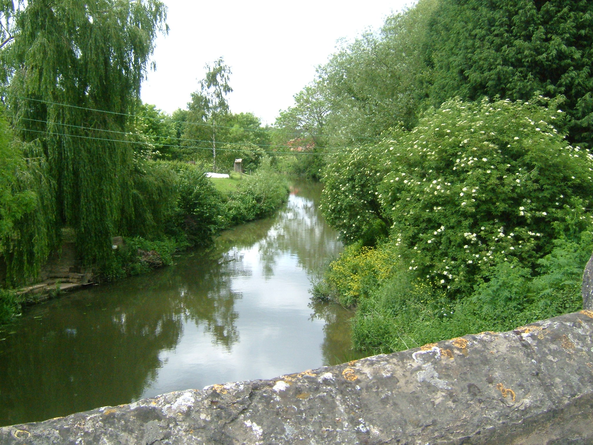
| Description |
Taken from Town Bridge. Riverside dwellings on the River Beult at Yalding behind the post office, just before it joins the Medway. At Yalding there is an automatic sluice where the river drops from +11.2m to +7.41m above mean sea level (which it here). The navigation bears left through the Hampstead Lane Canal, and the Hampstead Lock, the main stream drops over the weir and sluice and is joined by the River Teise (Lesser Teise) and both pass under Twyford Bridge.
The river then flows in a loop towards Yalding, where it is joined by the River Beult which has been joined by the River Teise (the other bit!) and passes under Town Bridge. Town bridge lies 16.5 km from Allington. Town bridge is the longest mediaeval bridge in Kent. |
|||
|---|---|---|---|---|
| Source |
own work |
|||
| Date |
May 2007 |
|||
| Author | ||||
| Permission (Reusing this image) |
see below |
[edit] Licensing
|

File history
Click on a date/time to view the file as it appeared at that time.
| Date/Time | Dimensions | User | Comment | |
|---|---|---|---|---|
| current | 13:31, 3 June 2007 | 2,016×1,512 (749 KB) | ClemRutter | (== Summary == {{Information |Description= Riverside dwellings on the River Beult at Yalding behind the post office, just before it joins the Medway. At Yalding there is an automatic sluice where the river drops from +11.2m to +7.41m above mean sea level () |
File links
Metadata
This file contains additional information, probably added from the digital camera or scanner used to create or digitize it. If the file has been modified from its original state, some details may not fully reflect the modified file.
| Camera manufacturer | FUJIFILM |
|---|---|
| Camera model | FinePix F610 |
| Exposure time | 1/450 sec (0.0022222222222222) |
| F-number | f/5 |
| Date and time of data generation | 13:27, 31 May 2007 |
| Lens focal length | 8.5 mm |
| Orientation | Normal |
| Horizontal resolution | 72 dpi |
| Vertical resolution | 72 dpi |
| Software used | Digital Camera FinePix F610 Ver1.00 |
| File change date and time | 13:27, 31 May 2007 |
| Y and C positioning | 2 |
| Exposure Program | Normal program |
| ISO speed rating | 400 |
| Exif version | 2.2 |
| Date and time of digitizing | 13:27, 31 May 2007 |
| Image compression mode | 2 |
| Shutter speed | 8.8 |
| Aperture | 4.6 |
| Brightness | 6.91 |
| Exposure bias | 0 |
| Maximum land aperture | 3 |
| Metering mode | Pattern |
| Light source | Unknown |
| Flash | 16 |
| Color space | sRGB |
| Focal plane X resolution | 2631 |
| Focal plane Y resolution | 2631 |
| Focal plane resolution unit | 3 |
| Sensing method | One-chip color area sensor |
| Custom image processing | Normal process |
| Exposure mode | Auto exposure |
| White balance | Auto white balance |
| Scene capture type | Standard |
| Sharpness | 3 |
| Subject distance range | Unknown |

