Image:WWI.png
From Wikipedia, the free encyclopedia
Size of this preview: 800 × 370 pixels
Full resolution (1,357 × 628 pixels, file size: 17 KB, MIME type: image/png)
| | This is a file from the Wikimedia Commons. The description on its description page there is shown below.
|
| Description |
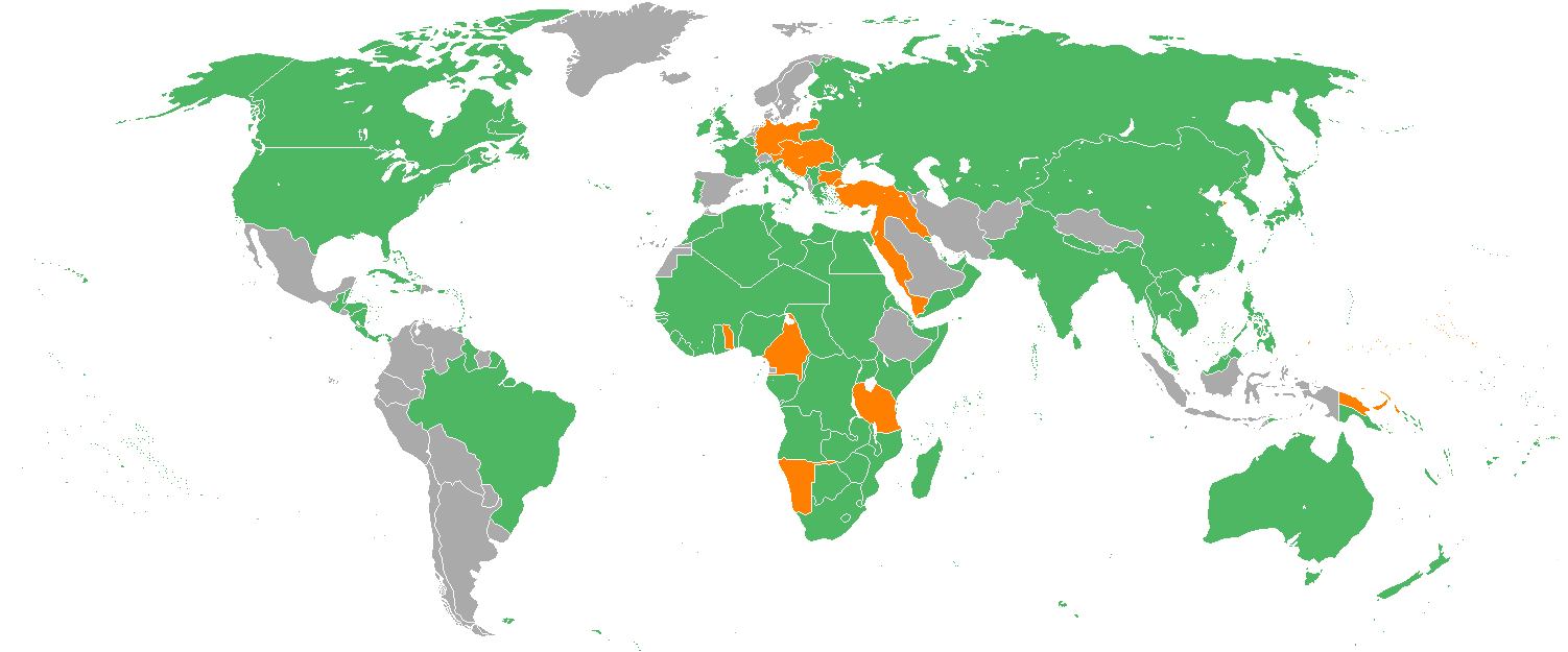
Map with the en:Participants in World War I:
|
|---|---|
| Source |
Originally from en.wikipedia; description page is/was here. |
| Date |
2006-05-27 (first version); 2007-02-14 (last version) |
| Author |
Original uploader was Dereye at en.wikipedia Later versions were uploaded by Helmandsare, Joaopais, El Jaber, Aivazovsky at en.wikipedia. |
| Permission (Reusing this image) |
Released under the GNU Free Documentation License; GFDL. |
[edit] License information

[edit] Original upload log
(All user names refer to en.wikipedia)
- 2007-02-14 15:32 Aivazovsky 1357×628×8 (30657 bytes) Fixed northern islands of Russia and Norway, fixed borders of Russia's South Caucasus territory
- 2006-05-27 09:22 Dereye 1357×628×8 (30663 bytes) Reverted to earlier revision
- 2006-05-27 09:22 Dereye 1357×628×8 (30365 bytes) Reverted to earlier revision
- 2006-05-02 21:54 Helmandsare 1357×628×8 (30663 bytes)
- 2006-01-19 19:34 Joaopais 1357×628×8 (30415 bytes)
- 2006-01-15 12:12 El Jaber 1357×628×8 (45477 bytes) Map with the [[Participants in World War I]]: * <font color="green">''Green''</font>: [[Allies of World War I|Allies]] * <font color="red">''Red''</font>: [[Central Powers]] * <font color="yellow">''Yellow''</font>: [[Neutral Country|Neutral Countries]]
- 2005-12-22 00:53 Joaopais 1357×628×8 (30366 bytes) added Belize and the Guyanas (at the time British and French colonies)
- 2005-12-22 00:19 Joaopais 1357×628×8 (30365 bytes) Map with the [[Participants in World War I]]: * <font color="green">''Green''</font>: [[Allies of World War I|Allies]] * <font color="orange">''Orange''</font>: [[Axis Powers]]
- Green: Allies
- Orange: en:Central Powers
- Gray: Neutral Countries
[edit] See also
 Version with Tibet joined to China |
 Allies/central powers, early August 1914 |
 Allies/central powers, May 1918 |
 World Map with the participants in World War II |
File history
Click on a date/time to view the file as it appeared at that time.
| Date/Time | Dimensions | User | Comment | |
|---|---|---|---|---|
| current | 08:01, 1 February 2008 | 1,357×628 (17 KB) | Xiong Chiamiov | (optimized using optipng) |
| 14:13, 15 April 2007 | 1,357×628 (30 KB) | Holek | ({{Information |Description=Map with the en:Participants in World War I: * <font color="green">'''Green'''</font>: Allies * <font color="orange">'''Orange'''</font>: en:Central Powers * <font color="gray">'''Gray'''<) |
File links
The following pages on the English Wikipedia link to this file (pages on other projects are not listed):

