Image:Wostok-Station core32.jpg
From Wikipedia, the free encyclopedia
Size of this preview: 800 × 515 pixels
Full resolution (1,000 × 644 pixels, file size: 89 KB, MIME type: image/jpeg)
| | This is a file from the Wikimedia Commons. The description on its description page there is shown below.
|
| Description |
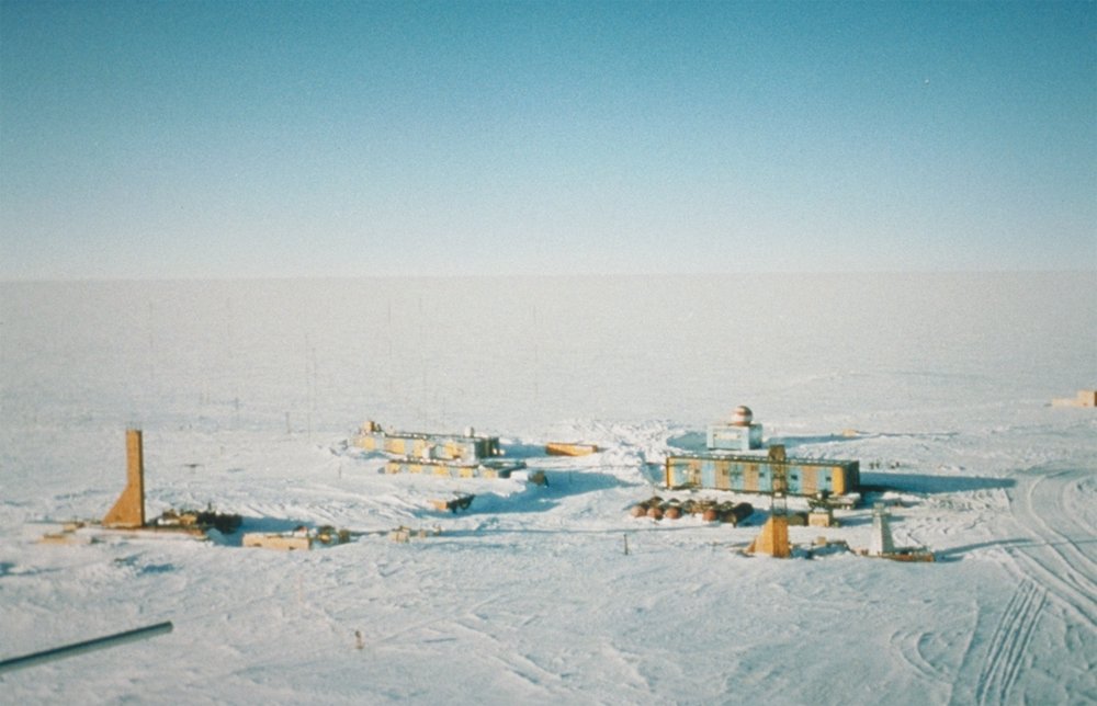
Wostok-Station (NOAA) Quelle: http://www.ngdc.noaa.gov/paleo/slides/slideset/15/15_300_slide.html Lizenz: PD Beschreibung: Vostok Site The Vostok site was chosen by the Soviet Union for the deep coring possibilities it offered. French and, later, American scientists became interested in the Soviet research and began to participate in coring activities at the site. This panoramic photo of Vostok Station shows the layout of the camp. The striped building on the left is the power station while the striped building on the right is where researchers sleep and take meals. The building in the background with the red- and white-striped ball on top is the meteorology building. Caves were dug into the ice sheet for storage, keeping cores at an ideal -55 degrees C year round. Photo Credits: Todd Sowers LDEO, Columbia University, Palisades, New York. |
|||
|---|---|---|---|---|
| Source |
Originally from de.wikipedia; description page is/was here. |
|||
| Date |
2004-07-02 (original upload date) |
|||
| Author |
Original uploader was Srbauer at de.wikipedia |
|||
| Permission (Reusing this image) |
|
[edit] Original upload log
(All user names refer to de.wikipedia)
- 2004-07-02 17:33 Srbauer 768×494×8 (45575 bytes) Wostok-Station (NOAA)
File history
Click on a date/time to view the file as it appeared at that time.
| Date/Time | Dimensions | User | Comment | |
|---|---|---|---|---|
| current | 20:21, 5 April 2007 | 1,000×644 (89 KB) | Raul6 | |
| 12:16, 4 February 2007 | 768×494 (45 KB) | Hardscarf | ({{Information |Description=Wostok-Station (NOAA) Quelle: http://www.ngdc.noaa.gov/paleo/slides/slideset/15/15_300_slide.html Lizenz: PD Beschreibung: Vostok Site The Vostok site was chosen by the Soviet Union for the deep coring possibilities it offer) |

