Image:Wilsons Promontory.png
From Wikipedia, the free encyclopedia
Size of this preview: 479 × 599 pixels
Full resolution (505 × 632 pixels, file size: 571 KB, MIME type: image/png)
| | This is a file from the Wikimedia Commons. The description on its description page there is shown below.
|
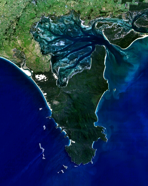
w:Wilsons Promontory, the southernmost point on the Australian mainland.
| This image is in the public domain because it is a screenshot from NASA’s globe software World Wind using Blue Marble, Landsat or USGS layer, all of which are in public domain. |
|
File history
Click on a date/time to view the file as it appeared at that time.
| Date/Time | Dimensions | User | Comment | |
|---|---|---|---|---|
| current | 04:54, 30 December 2005 | 505×632 (571 KB) | Thebainer | (w:Wilsons Promontory, the southernmost point on the Australian mainland. {{PD-WorldWind}}) |
File links
The following pages on the English Wikipedia link to this file (pages on other projects are not listed):

