Image:White Sea Canal map.png
From Wikipedia, the free encyclopedia
Size of this preview: 699 × 600 pixels
Full resolution (1,000 × 858 pixels, file size: 351 KB, MIME type: image/png)
| | This is a file from the Wikimedia Commons. The description on its description page there is shown below.
|
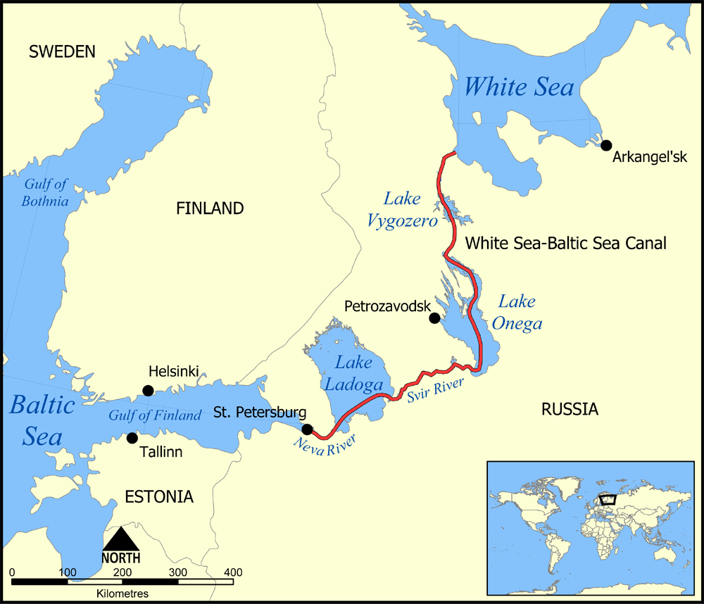
This map shows the route of the White Sea-Baltic Sea Canal ("Belomorkanal") between the White Sea and Baltic Sea. It shows the lakes Vygozero, Onega, and Ladoga, and the Sivr and Neva rivers too.
Created by NormanEinstein, December 6, 2005.

File history
Click on a date/time to view the file as it appeared at that time.
| Date/Time | Dimensions | User | Comment | |
|---|---|---|---|---|
| current | 17:59, 6 December 2005 | 1,000×858 (351 KB) | NormanEinstein | (This map shows the route of the White Sea-Baltic Sea Canal between the White Sea and Baltic Sea. (Heh heh.) It shows the lakes Vygozero, Onega, and Ladoga, and the Sivr and Neva rivers too. Created by NormanEinstein, December 6, 2005. {{GFDL-self}} [[C) |
File links
The following pages on the English Wikipedia link to this file (pages on other projects are not listed):

