Image:Wfm area 51 landsat geocover 2000.jpg
From Wikipedia, the free encyclopedia
Size of this preview: 475 × 599 pixels
Full resolution (752 × 948 pixels, file size: 383 KB, MIME type: image/jpeg)
| | This is a file from the Wikimedia Commons. The description on its description page there is shown below.
|
| Description |
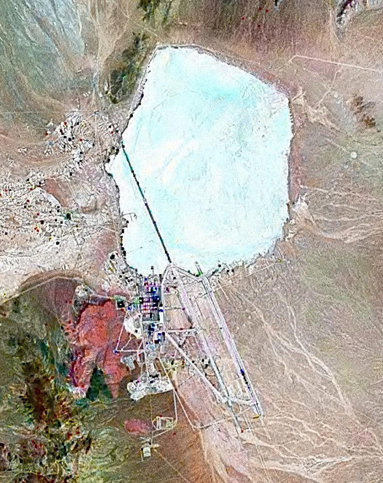
Landsat geocover 2000 pseudocolour imagery of Area 51 at Groom Lake, Nevada, USA |
|||
|---|---|---|---|---|
| Source |
NASA Landsat |
|||
| Date |
around 2000 |
|||
| Author |
NASA |
|||
| Permission (Reusing this image) |
|
File history
Click on a date/time to view the file as it appeared at that time.
| Date/Time | Dimensions | User | Comment | |
|---|---|---|---|---|
| current | 12:51, 16 July 2006 | 752×948 (383 KB) | Finlay McWalter | ({{Information |Description=Landsat geocover 2000 pseudocolour imagery of Area 51 at Groom Lake, Nevada, USA |Source=NASA Landsat |Date=around 2000 |Author=NASA |Permission= {{PD-WorldWind}} |other_versions= }} Category:Area 51 ) |
File links
The following pages on the English Wikipedia link to this file (pages on other projects are not listed):
Metadata
This file contains additional information, probably added from the digital camera or scanner used to create or digitize it. If the file has been modified from its original state, some details may not fully reflect the modified file.
| Orientation | Normal |
|---|---|
| Horizontal resolution | 72 dpi |
| Vertical resolution | 72 dpi |
| Software used | Adobe Photoshop 7.0 |
| File change date and time | 13:47, 16 July 2006 |
| Color space | 65535 |

