Image:Washington population map.png
From Wikipedia, the free encyclopedia
No higher resolution available.
Washington_population_map.png (740 × 400 pixels, file size: 33 KB, MIME type: image/png)
| | This is a file from the Wikimedia Commons. The description on its description page there is shown below.
|
[edit] Sumario
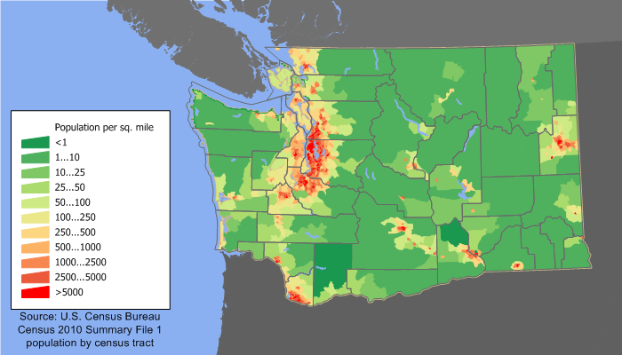
Washington population density map based on census 2000 data. See the data lineage for a process description. Author: User:JimIrwin
[edit] Licensing

File history
Click on a date/time to view the file as it appeared at that time.
| Date/Time | Dimensions | User | Comment | |
|---|---|---|---|---|
| current | 13:57, 1 October 2006 | 740×400 (33 KB) | Mortadelo2005 | (Washington population density map based on census 2000 data. See the data lineage for a process description. Author: User:JimIrwin Category:Washington) |
File links
The following pages on the English Wikipedia link to this file (pages on other projects are not listed):

