Image:Vulcano bransfield-strait hg.png
From Wikipedia, the free encyclopedia
Size of this preview: 800 × 537 pixels
Full resolution (3,132 × 2,104 pixels, file size: 934 KB, MIME type: image/png)
| | This is a file from the Wikimedia Commons. The description on its description page there is shown below.
|
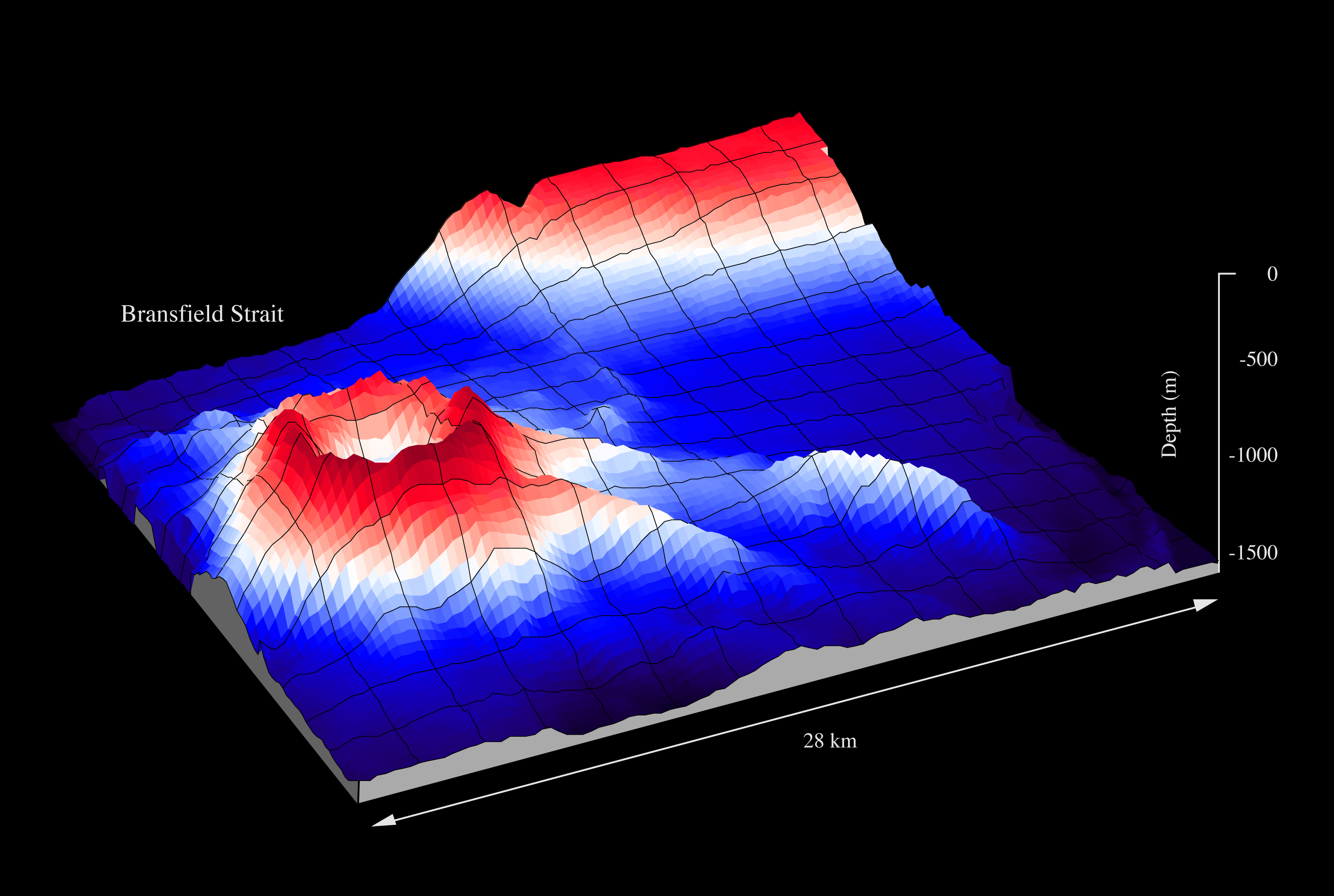
| Description |
Orca Seamount in the Bransfield Strait, Antarctic Peninsula |
|---|---|
| Source |
graf own work - data Fred Niederjasper, AWI, mapped with the swath sonar system of RV POLARSTERN during cruise ANT-XI/3 |
| Date |
1994 |
| Author |
Hannes Grobe, Alfred Wegener Institute for Polar and Marine Research |
| Permission (Reusing this image) |
Own work, share alike, attribution required (Creative Commons CC-BY-SA-2.5) |
| Other versions | published by Hatzky (2005) DOI:10.1594/PANGAEA.341126 |
|
File history
Click on a date/time to view the file as it appeared at that time.
| Date/Time | Dimensions | User | Comment | |
|---|---|---|---|---|
| current | 09:32, 23 June 2007 | 3,132×2,104 (934 KB) | Hgrobe | ({{Information |Description=to be defined |Source=own work |Date=2007-06-20 |Author=~~~~, Alfred Wegener Institute for Polar and Marine Research, Bremerhaven, Germany |Permission=Own work, share alike, attribution required (Creative Commons CC-BY-SA-2.5) |) |
File links
The following pages on the English Wikipedia link to this file (pages on other projects are not listed):

