Image:Victoria cadastral divisions.png
From Wikipedia, the free encyclopedia
Size of this preview: 800 × 558 pixels
Full resolution (1,000 × 697 pixels, file size: 133 KB, MIME type: image/png)
| | This is a file from the Wikimedia Commons. The description on its description page there is shown below.
|
[edit] Summary
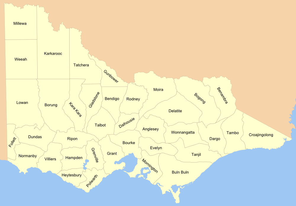
Map of the Counties of Victoria, see 1876 map from the National Library collection.
[edit] Licensing

File history
Click on a date/time to view the file as it appeared at that time.
| Date/Time | Dimensions | User | Comment | |
|---|---|---|---|---|
| current | 11:57, 9 March 2007 | 1,000×697 (133 KB) | Roke | (islands, borders) |
| 11:56, 8 March 2007 | 1,000×697 (122 KB) | Roke | (Map of the Counties of Victoria, see [http://www.nla.gov.au/apps/cdview?pi=nla.map-f285-1 1876 map] from the National Library collection. Category:Maps of Victoria Category:Maps of the history of Australia) |
File links
The following pages on the English Wikipedia link to this file (pages on other projects are not listed):

