Image:Vanuatu Provinces.JPG
From Wikipedia, the free encyclopedia
Size of this preview: 549 × 599 pixels
Full resolution (558 × 609 pixels, file size: 36 KB, MIME type: image/jpeg)
| | This is a file from the Wikimedia Commons. The description on its description page there is shown below.
|
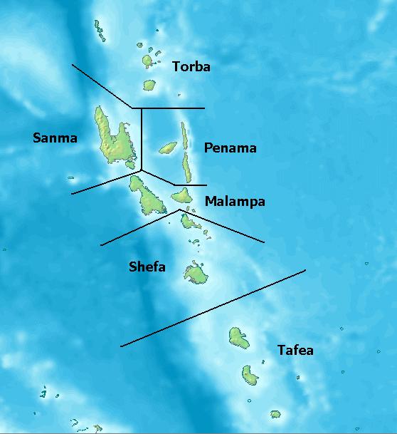
Map of Provinces of Vanuatu. Created with [ http://www2.demis.nl/mapserver/mapper.asp DEMIS World Map Server]
License: http://www2.demis.nl/mapserver/DataSrc.htm
| This file has been released into the public domain by the copyright holder, its copyright has expired, or it is ineligible for copyright. This applies worldwide. | |
Note: This tag is obsolete! Nothing is public domain without a reason. Don't use this generic template - please use instead:
العربية | Български | Česky | Deutsch | English | Español | Français | हिन्दी | Italiano | 日本語 | Norsk (bokmål) | Norsk (nynorsk) | Português | Русский | Slovenčina | Slovenščina | Српски / Srpski | Polski | Türkçe | 中文 | +/- |
File history
Click on a date/time to view the file as it appeared at that time.
| Date/Time | Dimensions | User | Comment | |
|---|---|---|---|---|
| current | 00:10, 25 July 2005 | 558×609 (36 KB) | Taichi | (Map of Provinces of Vanuatu. Created with [ http://www2.demis.nl/mapserver/mapper.asp DEMIS World Map Server] License: http://www2.demis.nl/mapserver/DataSrc.htm {{PD}} Category:Maps) |
File links
The following pages on the English Wikipedia link to this file (pages on other projects are not listed):

