Image:Vancouver1798map-SanJuan-Gulf.png
From Wikipedia, the free encyclopedia
Size of this preview: 521 × 599 pixels
Full resolution (766 × 881 pixels, file size: 1.39 MB, MIME type: image/png)
| | This is a file from the Wikimedia Commons. The description on its description page there is shown below.
|
[edit] Summary
| Description |
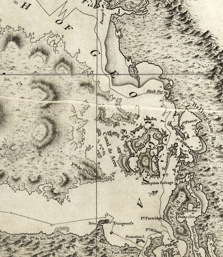
Excerpt of a map by George Vancouver, titled "A chart shewing part of the coast of N.W. America : with the tracks of His Majesty's sloop Discovery and armed tender Chatham / commanded by George Vancouver, Esqr. and prepared under his immediate inspection by Lieut. Joseph Baker..."; published 1798 |
|---|---|
| Source | |
| Date |
1798 |
| Author |
George Vancouver; digital version, Library of Congress, Geography and Map Division. |
| Permission (Reusing this image) |
"The Library of Congress is providing access to these materials for educational and research purposes and is not aware of any U.S. copyright protection" (source: [1]) |
[edit] Licensing
| This work is in the public domain in the United States because it is a work of the United States Federal Government under the terms of Title 17, Chapter 1, Section 105 of the US Code. See Copyright.
Note: This only applies to works of the Federal Government and not to the work of any individual U.S. state, territory, commonwealth, county, municipality, or any other subdivision. العربية | Български | Česky | Deutsch | English | Español | Français | Magyar | Italiano | 日本語 | 한국어 | Polski | Português | 中文(繁體) | 中文(简体) | +/- |
 |
| This map is available from the United States Library of Congress's Geography & Map Division under the digital ID g3512c ct000914 This tag does not indicate the copyright status of the attached work. A normal copyright tag is still required. See Commons:Licensing for more information. |
File history
Click on a date/time to view the file as it appeared at that time.
| Date/Time | Dimensions | User | Comment | |
|---|---|---|---|---|
| current | 06:42, 16 May 2008 | 766×881 (1.39 MB) | Pfly | ({{Information |Description=Excerpt of a map by George Vancouver, titled "A chart shewing part of the coast of N.W. America : with the tracks of His Majesty's sloop Discovery and armed tender Chatham / commanded by George Vancouver, Esqr. and prepared unde) |

