Image:VAMap-doton-Wise.PNG
From Wikipedia, the free encyclopedia
No higher resolution available.
VAMap-doton-Wise.PNG (300 × 134 pixels, file size: 9 KB, MIME type: image/png)
| | This is a file from the Wikimedia Commons. The description on its description page there is shown below.
|
| Description |
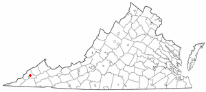
uploaded to Wikimedia Commons at Image:Map of Virginia highlighting Wise (small).png
|
|---|---|
| Source |
Originally from en.wikipedia; description page is/was here. |
| Date |
2005-05-15 (original upload date) |
| Author |
Original uploader was Seth Ilys at en.wikipedia |
| Permission (Reusing this image) |
Released under the GNU Free Documentation License. |
[edit] License information
 |
Permission is granted to copy, distribute and/or modify this document under the terms of the GNU Free Documentation License, Version 1.2 or any later version published by the Free Software Foundation; with no Invariant Sections, no Front-Cover Texts, and no Back-Cover Texts. Subject to disclaimers. Asturianu | Български | Català | Deutsch | English | Español | Français | Gaeilge | Italiano | 한국어 | 日本語 | Polski | Português | Română | Türkçe | +/- |
[edit] Original upload log
(All user names refer to en.wikipedia)
- 2005-05-15 19:16 Seth Ilys 300×134×8 (8897 bytes) {{GFDL}}<br>Adapted from Wikipedia's VA county maps by [[User:Seth Ilys|Seth Ilys]].
File history
Click on a date/time to view the file as it appeared at that time.
| Date/Time | Dimensions | User | Comment | |
|---|---|---|---|---|
| current | 16:02, 13 July 2007 | 300×134 (9 KB) | SieBot | ( {{Information |Description=uploaded to Wikimedia Commons at Image:Map of Virginia highlighting Wise (small).png <br>Adapted from Wikipedia's VA county maps by [[:en:User:Seth Ilys|Seth) |
File links
The following pages on the English Wikipedia link to this file (pages on other projects are not listed):

