Image:USGS deep wells 1997.png
From Wikipedia, the free encyclopedia
Size of this preview: 800 × 480 pixels
Full resolution (1,108 × 665 pixels, file size: 276 KB, MIME type: image/png)
| | This is a file from the Wikimedia Commons. The description on its description page there is shown below.
|
[edit] Summary
| Description |
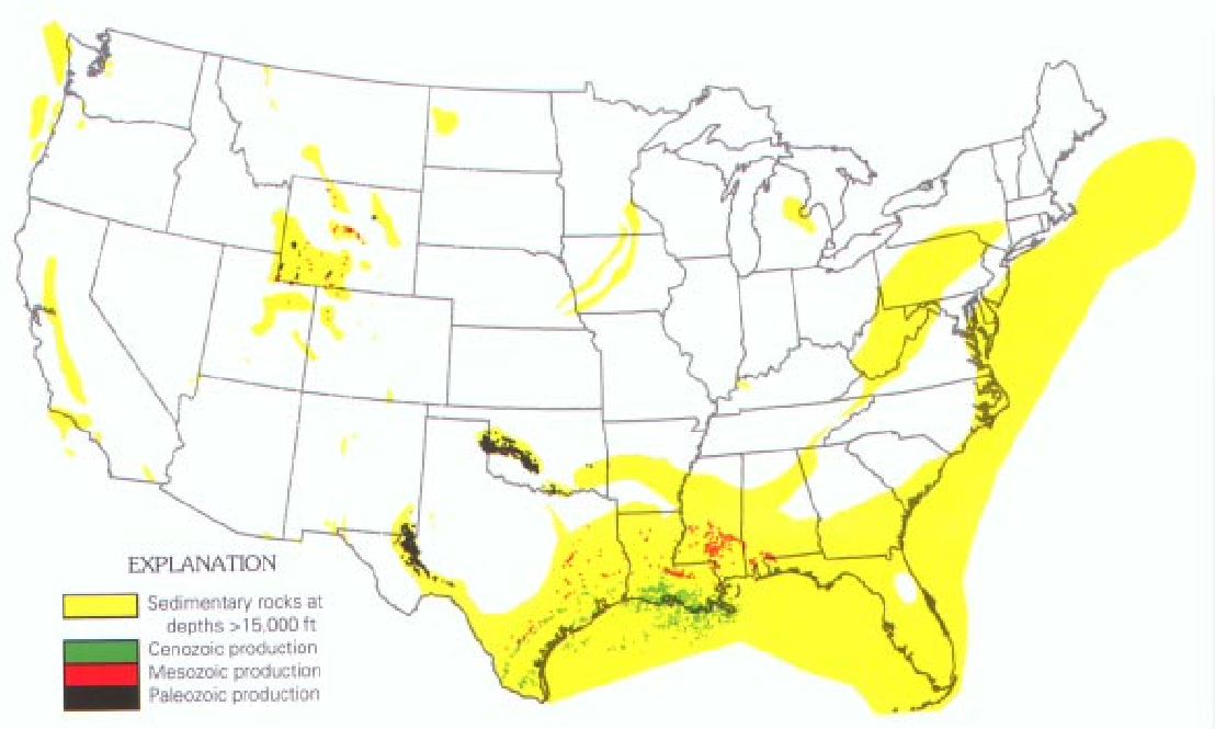
Map of the United States showing wells that have produced hydrocarbons from depths greater than 15,000 feet (4,572 m), grouped by geologic age of the producing formation. |
|---|---|
| Source |
USGS bulletin 2146: Geologic Controls of Deep Natural Gas Resources in the United States http://pubs.usgs.gov/bul/b2146/b2146.html |
| Date |
1997 |
| Author |
United States Geological Survey |
| Permission (Reusing this image) |
see below |
[edit] Licensing
| This work is in the public domain in the United States because it is a work of the United States Federal Government under the terms of Title 17, Chapter 1, Section 105 of the US Code. See Copyright.
Note: This only applies to works of the Federal Government and not to the work of any individual U.S. state, territory, commonwealth, county, municipality, or any other subdivision. العربية | Български | Česky | Deutsch | English | Español | Français | Magyar | Italiano | 日本語 | 한국어 | Polski | Português | 中文(繁體) | 中文(简体) | +/- |
 |
File history
Click on a date/time to view the file as it appeared at that time.
| Date/Time | Dimensions | User | Comment | |
|---|---|---|---|---|
| current | 05:49, 5 October 2006 | 1,108×665 (276 KB) | SEWilco | ({{Information |Description=Map of the United States showing wells that have produced hydrocarbons from depths greater than 15,000 feet (4,572 m), grouped by geologic age of the producing formation. |Source=USGS bulletin 2146: ''Geologic Controls of Deep N) |
File links
The following pages on the English Wikipedia link to this file (pages on other projects are not listed):

