Image:UsedomWolin.png
From Wikipedia, the free encyclopedia
No higher resolution available.
UsedomWolin.png (543 × 419 pixels, file size: 12 KB, MIME type: image/png)
| | This is a file from the Wikimedia Commons. The description on its description page there is shown below.
|
| Description |
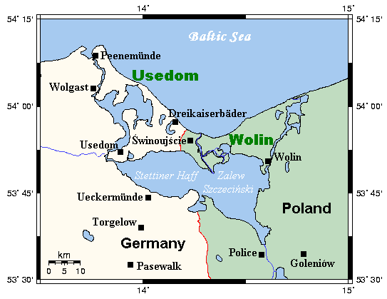
A map of the islands of Usedom and Wolin and environs, Germany/Poland. This map's source is here, with the uploader's modifications, and the GMT homepage says that the tools are released under the GNU General Public License. |
|---|---|
| Source |
Originally from en.wikipedia; description page is/was here. |
| Date |
2006-03-13 (original upload date) |
| Author |
Original uploader was Kelisi at en.wikipedia |
| Permission (Reusing this image) |
Released under the GNU Free Documentation License. |
[edit] License information

|
[edit] Original upload log
(All user names refer to en.wikipedia)
- 2006-03-13 21:35 Kelisi 543×419×8 (12000 bytes) A map of the islands of Usedom and Wolin and environs, Germany/Poland. This map's source is [http://www.aquarius.geomar.de/omc/make_map.html here], with the uploader's modifications, and the [http://gmt.soest.hawaii.edu/ GMT homepage] says that the tools
File history
Click on a date/time to view the file as it appeared at that time.
| Date/Time | Dimensions | User | Comment | |
|---|---|---|---|---|
| current | 16:43, 30 May 2007 | 543×419 (12 KB) | Frokor | ({{Information |Description=A map of the islands of Usedom and Wolin and environs, Germany/Poland. This map's source is [http://www.aquarius.geomar.de/omc/make_map.html here], with the uploader's modifications, and the [http://gmt.soest.hawaii.edu/ GMT hom) |
File links
The following pages on the English Wikipedia link to this file (pages on other projects are not listed):

