Image:US soldiers on the tigris river.jpg
From Wikipedia, the free encyclopedia
Size of this preview: 722 × 600 pixels
Full resolution (1,498 × 1,244 pixels, file size: 451 KB, MIME type: image/jpeg)
| | This is a file from the Wikimedia Commons. The description on its description page there is shown below.
|
| Description |
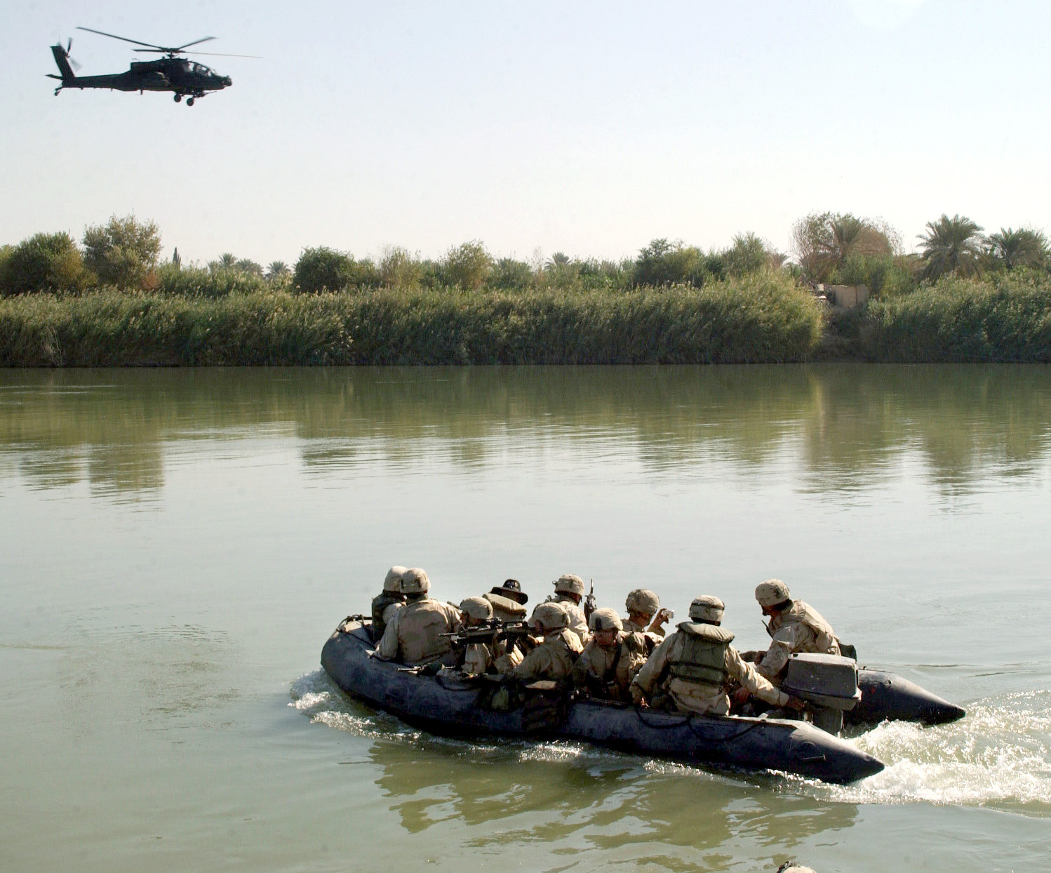
3-7 Cavalary, 3ID division soldiers on their way to one of the islands on tigris river for a search mission, 814th engineer company soldiers provided river crossing capabilities in support of combat operation, southeastern Baghdad, Iraq, 21 October, 2005 |
|||
|---|---|---|---|---|
| Source |
http://www4.army.mil/OCPA/uploads/large/CSA-2005-11-28-093459.jpg |
|||
| Date |
2005-10-21 |
|||
| Author |
Spc Gul A. Alisan |
|||
| Permission (Reusing this image) |
|

File history
Click on a date/time to view the file as it appeared at that time.
| Date/Time | Dimensions | User | Comment | |
|---|---|---|---|---|
| current | 13:49, 7 April 2007 | 1,498×1,244 (451 KB) | Hashekemist | ({{Information |Description=3-7 Cavalary, 3ID division soldiers on their way to one of the islands on tigris river for a search mission, 814th engineer company soldiers provided river crossing capabilities in support of combat operation, southeastern Baghd) |
File links
The following pages on the English Wikipedia link to this file (pages on other projects are not listed):
Metadata
This file contains additional information, probably added from the digital camera or scanner used to create or digitize it. If the file has been modified from its original state, some details may not fully reflect the modified file.
| Camera manufacturer | NIKON CORPORATION |
|---|---|
| Camera model | NIKON D1X |
| Exposure time | 1/350 sec (0.0028571428571429) |
| F-number | f/9.5 |
| Date and time of data generation | 07:24, 21 October 2005 |
| Lens focal length | 28 mm |
| Orientation | Normal |
| Horizontal resolution | 72 dpi |
| Vertical resolution | 72 dpi |
| Software used | Adobe Photoshop 7.0 |
| File change date and time | 09:35, 28 November 2005 |
| Author | Spc Gul A. Alisan |
| Y and C positioning | 2 |
| Exposure Program | Normal program |
| Exif version | 2.1 |
| Date and time of digitizing | 07:24, 21 October 2005 |
| Image compression mode | 4 |
| Exposure bias | 0 |
| Maximum land aperture | 3.6 |
| Metering mode | Spot |
| DateTime subseconds | 53 |
| DateTimeOriginal subseconds | 53 |
| DateTimeDigitized subseconds | 53 |
| Color space | sRGB |
| Sensing method | One-chip color area sensor |

