Image:US insular areas-B.png
From Wikipedia, the free encyclopedia
Size of this preview: 800 × 337 pixels
Full resolution (1,482 × 624 pixels, file size: 51 KB, MIME type: image/png)
| | This is a file from the Wikimedia Commons. The description on its description page there is shown below.
|
[edit] Summary
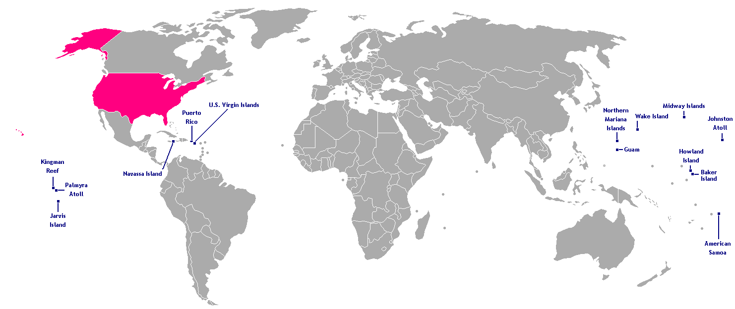
This is a map of the US Insular areas. The first version of this map was based off Image:BlankMap-World-v6.png by User:Astrokey44 with the locations of a few islands added; the source for this are two CIA maps; the maps are a map of the Pacific region and a map of the United States Pacific Island Wildlife Refuges. Hawaii has also been added to the map. Names of the islands are from the CIA Factbook. The second version is based off Image:Dependent_territories_2007.png by User:Sesmith.
For a version color-coded by each islands' status, see Image:US_insular_areas.png. For a version with the freely associated states, see Image:US_insular_areas-B FAS.png.
The previous map is under the GFDL; because of this, this map is too.
 |
This map image should be recreated using vector graphics as an SVG file. This has several advantages; see Commons:Media for cleanup for more information. If an SVG form of this image is already available, please upload it. After uploading an SVG, replace this template with template {{Vector version available|new image name.svg}} in this image. |
|
العربية | Български | Català | Česky | Dansk | Deutsch | English | Esperanto | Español | Français | 한국어 | Italiano | Magyar | Lietuvių | Nederlands | 日本語 | Polski | Português | Română | Русский | Suomi | Svenska | Türkçe | Українська | Tiếng Việt | मराठी | 中文(繁體) | 中文(简体) | +/- |
|
[edit] Licensing

File history
Click on a date/time to view the file as it appeared at that time.
| Date/Time | Dimensions | User | Comment | |
|---|---|---|---|---|
| current | 11:10, 9 January 2008 | 1,482×624 (51 KB) | Hoshie | (rebuilt using User:Sesmith's maps; more to come.) |
| 10:43, 17 March 2007 | 1,482×624 (32 KB) | Hoshie | (This is a map of the US Insular areas. The base map is Image:BlankMap-World-v6.png by User:Astrokey44 with the locations of a few islands added; the source for this are two CIA maps; the maps are a [https://www.cia.gov/cia/publications/factbook/r) |

