Image:US Roman Catholic dioceses map.png
From Wikipedia, the free encyclopedia
Size of this preview: 800 × 520 pixels
Full resolution (1,513 × 983 pixels, file size: 29 KB, MIME type: image/png)
| | This is a file from the Wikimedia Commons. The description on its description page there is shown below.
|
[edit] Summary
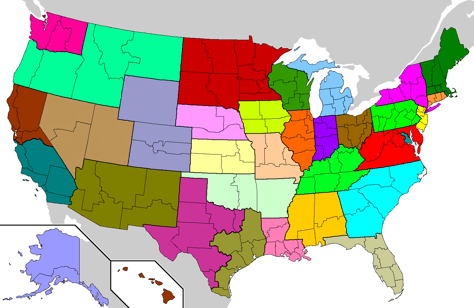
| Description |
Geographical Latin rite Roman Catholic dioceses of the United States. Each of the 32 ecclesiastical provinces is a separate color. Eastern rite eparchies and dioceses are not shown. |
|---|---|
| Source |
based on en:Image:Dioceses.GIF by John Kenney |
| Date | |
| Author | |
| Permission (Reusing this image) |
GDFL, same as original |
| Other versions | en:Image:Dioceses.GIF (older image but with same current data) |
Based on en:Image:Dioceses.GIF by John Kenney, which was based on U.S. county maps already on Wikipedia. Changes by Closeapple using The Gimp: made water bodies transparent; removed dithering on Canada and Mexico; gave each of the 32 provinces a unique color; colored Isle Royale in Michigan, islands in northwestern Washington state, and minor islands in Alaska, California, Florida, North Carolina, and Texas; removed some spurs left over from erased county lines.
Image characteristics: PNG format, 8-bit palette, 34 unique colors + 1 transparent entry (1 for each province; grey for Canada/Mexico; transparent for water). Recompressed with PNGOUT with 12288-byte blocks.
[edit] Licensing
Modifications released by Closeapple under the same GDFL terms as the original work by John Kenney. John Kenney source: "created myself, based on map of US counties already on wikipedia".

 |
This map image should be recreated using vector graphics as an SVG file. This has several advantages; see Commons:Media for cleanup for more information. If an SVG form of this image is already available, please upload it. After uploading an SVG, replace this template with template {{Vector version available|new image name.svg}} in this image. |
|
العربية | Български | Català | Česky | Dansk | Deutsch | English | Esperanto | Español | Français | 한국어 | Italiano | Magyar | Lietuvių | Nederlands | 日本語 | Polski | Português | Română | Русский | Suomi | Svenska | Türkçe | Українська | Tiếng Việt | मराठी | 中文(繁體) | 中文(简体) | +/- |
|
File history
Click on a date/time to view the file as it appeared at that time.
| Date/Time | Dimensions | User | Comment | |
|---|---|---|---|---|
| current | 06:19, 22 April 2006 | 1,513×983 (29 KB) | Closeapple | ({{Information| |Description=Geographical Latin rite w:Roman Catholic dioceses of the United States. Each of the 32 ecclesiastical provinces is a separate color. Eastern rite eparchies and dioceses are not shown. |Source=based on [[:en:Image:) |

