Image:US-Mexico-Nogales-Border.jpg
From Wikipedia, the free encyclopedia
Size of this preview: 450 × 600 pixels
Full resolution (1,200 × 1,600 pixels, file size: 799 KB, MIME type: image/jpeg)
| | This is a file from the Wikimedia Commons. The description on its description page there is shown below.
|
| Description |
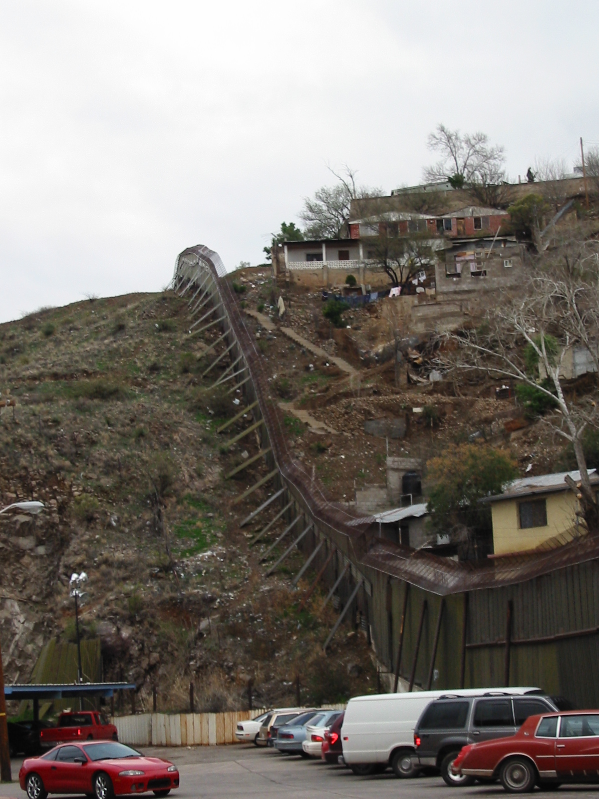
Picture of the US-Mexico Border, taken from Nogales, Arizona. The USA side of the border is on the left of the picture, while the Mexican side is on the right. The camera is pointed towards the east. |
|---|---|
| Source |
Originally from en.wikipedia; description page is/was here. |
| Date |
2005-06-23 (original upload date) |
| Author |
Original uploader was Darkros at en.wikipedia |
| Permission (Reusing this image) |
PD-USER-W |
[edit] License information
| This image has been (or is hereby) released into the public domain by its author, Darkros at the wikipedia project. This applies worldwide. In case this is not legally possible: |
[edit] Original upload log
(All user names refer to en.wikipedia)
- 2005-06-23 06:20 Darkros 1200×1600×8 (817762 bytes) Picture of the US-Mexico Border, taken from Nogales, Arizona. The USA side of the border is on the left of the picture, while the Mexican side is on the right. The camera is pointed towards the west.
File history
Click on a date/time to view the file as it appeared at that time.
| Date/Time | Dimensions | User | Comment | |
|---|---|---|---|---|
| current | 10:39, 26 September 2007 | 1,200×1,600 (799 KB) | Liftarn | ({{Information |Description=Picture of the US-Mexico Border, taken from Nogales, Arizona. The USA side of the border is on the left of the picture, while the Mexican side is on the right. The camera is pointed towards the east. |Source=Originally from [) |
File links
Metadata
This file contains additional information, probably added from the digital camera or scanner used to create or digitize it. If the file has been modified from its original state, some details may not fully reflect the modified file.
| Camera manufacturer | Canon |
|---|---|
| Camera model | Canon PowerShot A20 |
| Exposure time | 1/60 sec (0.016666666666667) |
| F-number | f/4 |
| Date and time of data generation | 17:32, 12 February 2005 |
| Lens focal length | 11.3125 mm |
| Orientation | Normal |
| Horizontal resolution | 180 dpi |
| Vertical resolution | 180 dpi |
| File change date and time | 17:32, 12 February 2005 |
| Y and C positioning | 1 |
| Exif version | 2.1 |
| Date and time of digitizing | 17:32, 12 February 2005 |
| Image compression mode | 5 |
| Shutter speed | 5.90625 |
| Aperture | 4 |
| Exposure bias | 0 |
| Maximum land aperture | 2.9708557128906 |
| Subject distance | 5.679 metres |
| Metering mode | Pattern |
| Flash | 1 |
| Color space | sRGB |
| Focal plane X resolution | 7766.9902912621 |
| Focal plane Y resolution | 7741.935483871 |
| Focal plane resolution unit | inches |
| Sensing method | One-chip color area sensor |

