Image:Typhoon Nari 2001.jpg
From Wikipedia, the free encyclopedia
Size of this preview: 460 × 600 pixels
Full resolution (4,600 × 6,000 pixels, file size: 4.59 MB, MIME type: image/jpeg)
| | This is a file from the Wikimedia Commons. The description on its description page there is shown below.
|
[edit] Summary
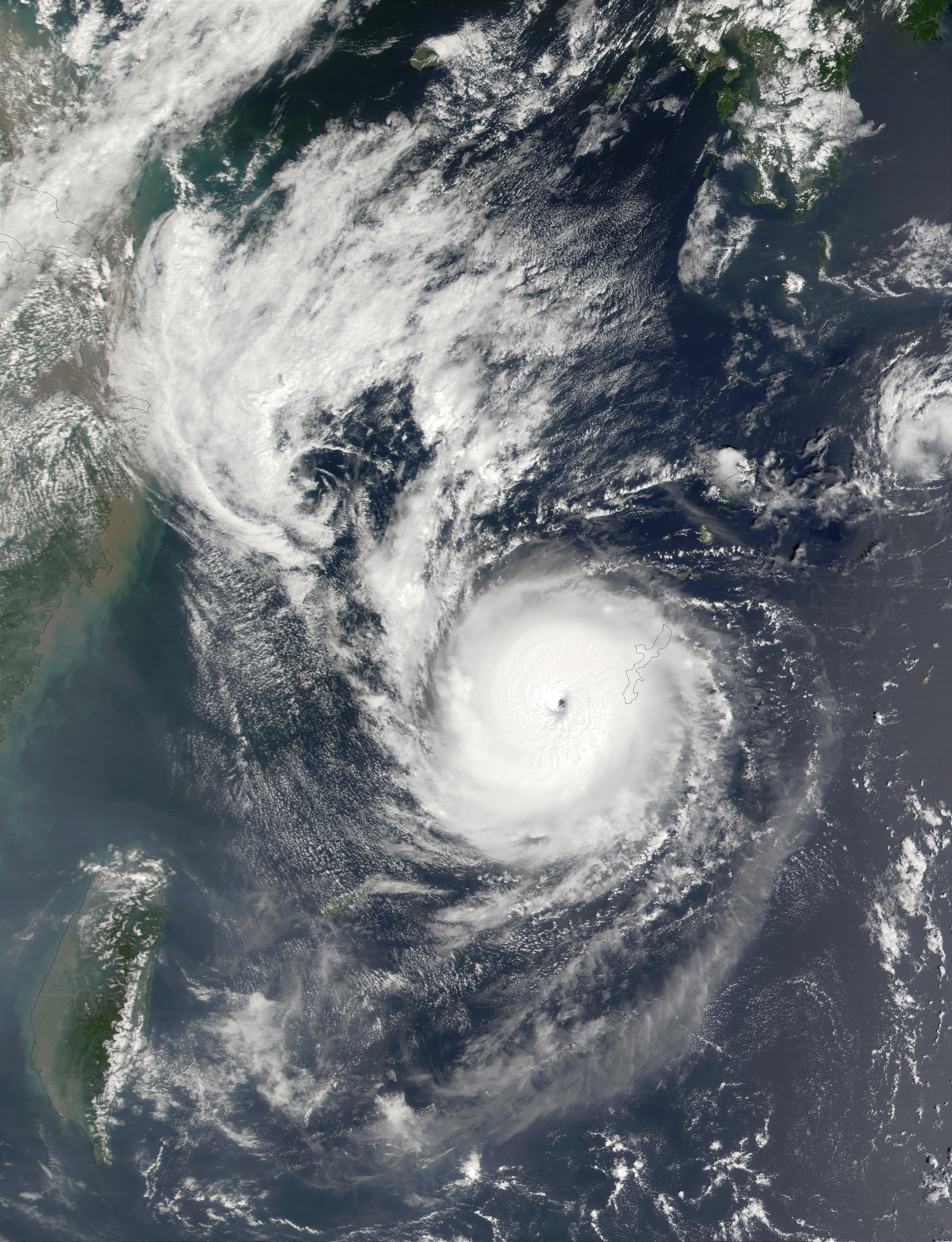
| Description |
Typhoon Nari on September 11, 2001 at 0210 UTC. Maximum sustained winds (10-minute average) were currently 65 knots. This true-color image of Nari was acquired by the Moderate-resolution Imaging Spectroradiometer (MODIS), flying aboard NASA's Terra satellite, on September 11. |
|||||
|---|---|---|---|---|---|---|
| Source |
http://rapidfire.sci.gsfc.nasa.gov/gallery/?2001254-0911/Nari.A2001254.0210.2km.jpg |
|||||
| Date |
2001-09-11 |
|||||
| Author |
Image courtesy of MODIS Rapid Response Project at NASA/GSFC |
|||||
| Permission (Reusing this image) |
|
|||||
| Other versions | Image:Nari 11 sept 2001 0210Z.jpg |

File history
Click on a date/time to view the file as it appeared at that time.
| Date/Time | Dimensions | User | Comment | |
|---|---|---|---|---|
| current | 14:40, 3 September 2006 | 4,600×6,000 (4.59 MB) | Good kitty | ({{Information |Description=On September 14, 2001, Typhoon Nari was located about 418 km (260 miles) northeast of Taipei, Taiwan, and was moving slowly southwestward at a rate of about 4 km per hour (2.5 mph). The storm was packing winds of up to 150 km pe) |
File links
The following pages on the English Wikipedia link to this file (pages on other projects are not listed):

