Image:TS Chantal 21 aug 2001 1924Z.jpg
From Wikipedia, the free encyclopedia
Size of this preview: 728 × 600 pixels
Full resolution (1,700 × 1,400 pixels, file size: 620 KB, MIME type: image/jpeg)
| | This is a file from the Wikimedia Commons. The description on its description page there is shown below.
|
[edit] Summary
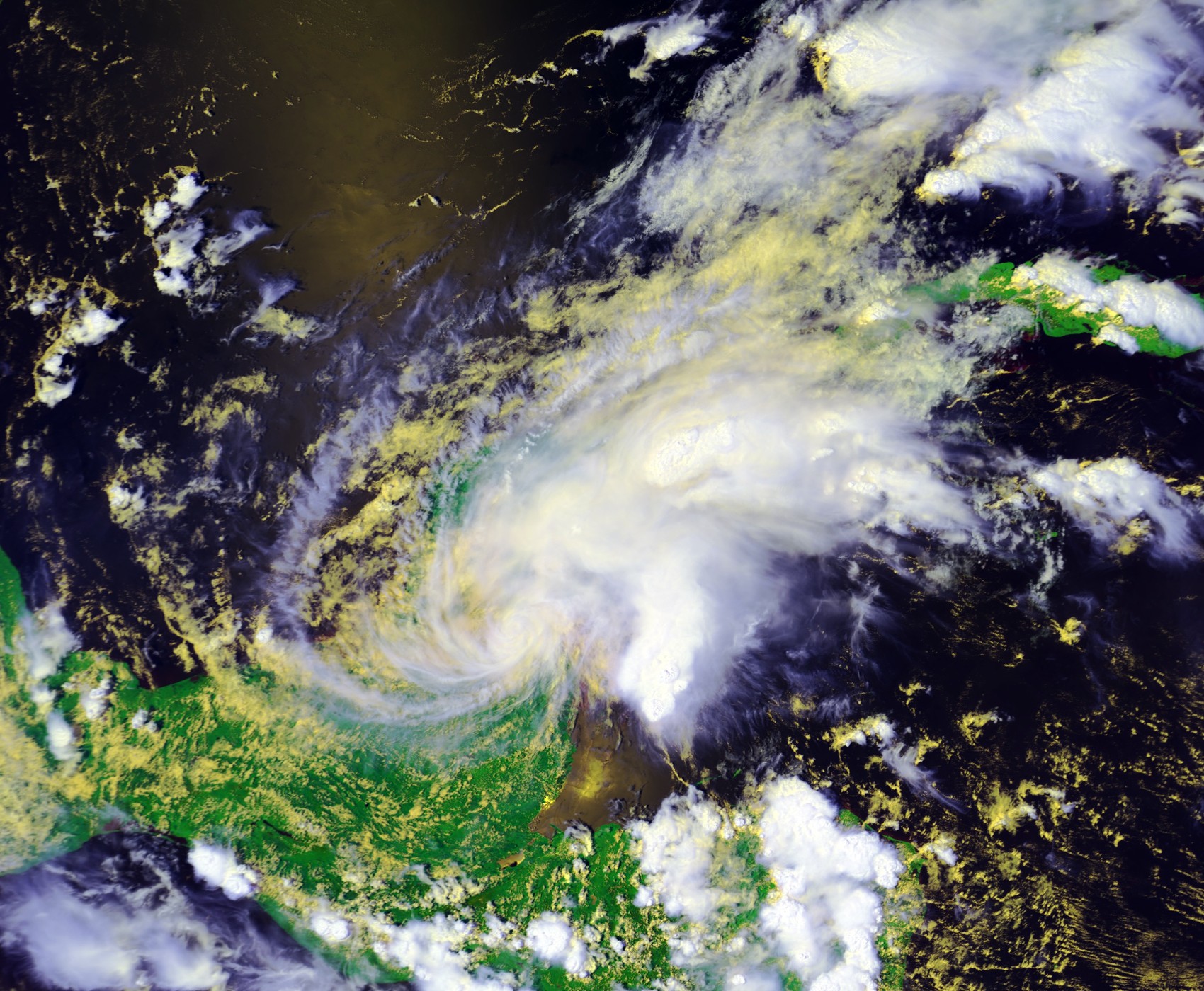
| Description |
Tropical Storm Chantal at landfall on August 21 at 1924 UTC. This image was produced from data from NOAA-16, provided by NOAA. The storm's maximum sustained winds were 40 mph. |
|||
|---|---|---|---|---|
| Source |
http://www.class.noaa.gov/ |
|||
| Date |
2001-08-21 |
|||
| Author |
NOAA / Satellite and Information Service |
|||
| Permission (Reusing this image) |
|
File history
Click on a date/time to view the file as it appeared at that time.
| Date/Time | Dimensions | User | Comment | |
|---|---|---|---|---|
| current | 03:18, 13 February 2007 | 1,700×1,400 (620 KB) | Good kitty | (== Summary == {{Information |Description=Tropical Storm Chantal at landfall on August 21 at 1924 UTC. This image was produced from data from NOAA-16, provided by NOAA. The storm's maximum sustained winds were 40 mph. |Source=http://www.class.noaa.gov/</br) |
File links
The following pages on the English Wikipedia link to this file (pages on other projects are not listed):

