Image:Tropical Storm Lisa (2004).jpg
From Wikipedia, the free encyclopedia
No higher resolution available.
Tropical_Storm_Lisa_(2004).jpg (642 × 482 pixels, file size: 53 KB, MIME type: image/jpeg)
| | This is a file from the Wikimedia Commons. The description on its description page there is shown below.
|
[edit] Summary
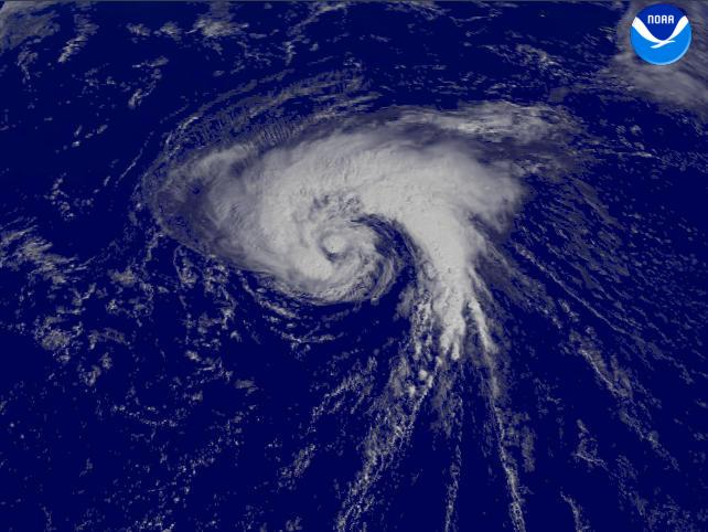
| Description |
This satellite image shows 70 mph Tropical Storm Lisa in the North Atlantic on September 29, 2004 at 1245 UTC. It would continue moving northward, reaching hurricane status on the 2nd before becoming extratropical. |
|||
|---|---|---|---|---|
| Source |
http://www.nnvl.noaa.gov/cgi-bin/index.cgi?page=items&ser=108356&large=1 |
|||
| Date |
2004-09-29 |
|||
| Author |
NOAA / Satellite and Information Service |
|||
| Permission (Reusing this image) |
|
File history
Click on a date/time to view the file as it appeared at that time.
| Date/Time | Dimensions | User | Comment | |
|---|---|---|---|---|
| current | 13:47, 25 December 2005 | 642×482 (53 KB) | Hurricanehink | (From http://www.nnvl.noaa.gov/cgi-bin/index.cgi?page=items&ser=108356&large=1, this satellite image shows 70 mph Tropical Storm Lisa in the North Atlantic on September 29, 2004. It would continue moving northward, reaching hurricane status on the 2nd befo) |
File links
The following pages on the English Wikipedia link to this file (pages on other projects are not listed):

