Image:Topographic maps of Arlington, Belmont, Lexington Massachusetts 1946.jpg
From Wikipedia, the free encyclopedia
Size of this preview: 629 × 600 pixels
Full resolution (2,560 × 2,440 pixels, file size: 2.68 MB, MIME type: image/jpeg)
| | This is a file from the Wikimedia Commons. The description on its description page there is shown below.
|
[edit] Summary
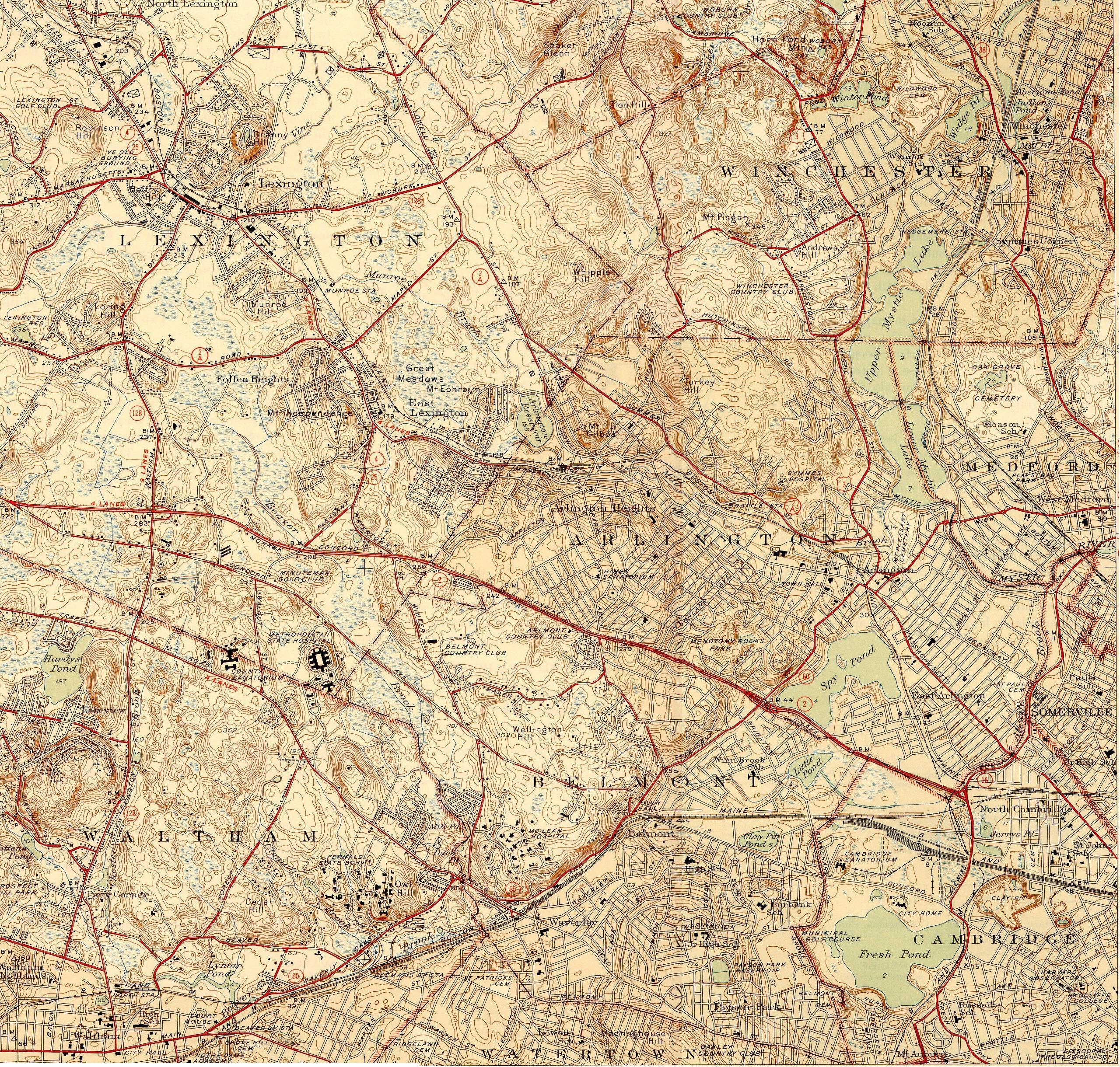
| Description |
Topographic maps of Arlington, Belmont, and Lexington, Massachusetts, as of 1946. Also includes much of Winchester. |
|---|---|
| Source |
USGS 7.5 Minute Series, Lexington, MA Quadrangle, 1946. Surveyed 1943. |
| Date |
1946. |
| Author |
United States Geological Survey, US Department of the Interior. |
| Permission (Reusing this image) |
Public domain - original work of the US Federal Government. |
[edit] Licensing
| This work is in the public domain in the United States because it is a work of the United States Federal Government under the terms of Title 17, Chapter 1, Section 105 of the US Code. See Copyright.
Note: This only applies to works of the Federal Government and not to the work of any individual U.S. state, territory, commonwealth, county, municipality, or any other subdivision. العربية | Български | Česky | Deutsch | English | Español | Français | Magyar | Italiano | 日本語 | 한국어 | Polski | Português | 中文(繁體) | 中文(简体) | +/- |
 |
File history
Click on a date/time to view the file as it appeared at that time.
| Date/Time | Dimensions | User | Comment | |
|---|---|---|---|---|
| current | 20:54, 17 December 2006 | 2,560×2,440 (2.68 MB) | Daderot | ({{Information |Description=Topographic maps of Arlington, Belmont, and Lexington, Massachusetts, as of 1946. Also includes much of Winchester. |Source=USGS 7.5 Minute Series, Lexington, MA Quadrangle, 1946. Surveyed 1943. |Date=1946. |Author=United States) |
File links
The following pages on the English Wikipedia link to this file (pages on other projects are not listed):

