Image:Topographic map of Socotra-en.svg
From Wikipedia, the free encyclopedia

Topographic_map_of_Socotra-en.svg (SVG file, nominally 1309 × 375 pixels, file size: 229 KB)
| | This is a file from the Wikimedia Commons. The description on its description page there is shown below.
|
[edit] Summary
| Description |
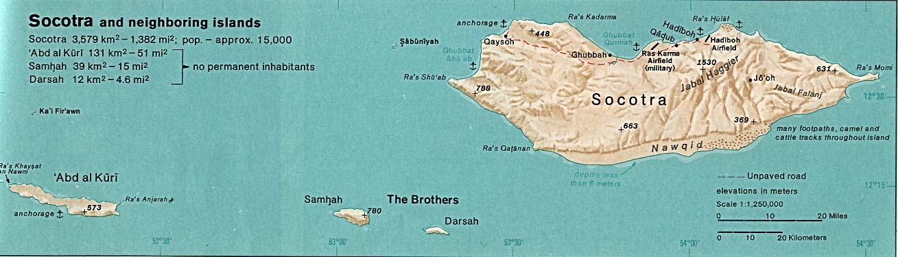
English: Topographic map of Socotra.
Français : Carte topographique du Socotra.
Suomi: Sokotran topografinen kartta.
|
|---|---|
| Source |
Self-made in Inkscape. |
| Date |
2008-05-20 |
| Author | |
| Permission (Reusing this image) |
see below |
 |
This SVG file uses embedded text that can be easily translated into your language. Learn more.
For SVG images, you can use this page to translate it into your language. العربية | Català | Dansk | Deutsch | English | Esperanto | Español | Français | Galego | Italiano | 日本語 | Lietuvių | Magyar | Nederlands | Polski | Português | Русский | Svenska | Українська | +/- |
[edit] Licensing:

File history
Click on a date/time to view the file as it appeared at that time.
| Date/Time | Dimensions | User | Comment | |
|---|---|---|---|---|
| current | 22:24, 19 May 2008 | 1,309×375 (229 KB) | Mysid | (bugfix #1) |
| 22:23, 19 May 2008 | 1,309×375 (229 KB) | Mysid | (== {{int:filedesc}} == {{Information |Description= {{en|Topographic map of en:Socotra.}} {{fr|Carte topographique du fr:Socotra.}} {{fi|fi:Sokotran topografinen kartta.}} |Source=Self-made in Inkscape.<br/>Boundaries, roads, and place na) |

