Image:Todd brook 077820 71f5b3dc.jpg
From Wikipedia, the free encyclopedia
No higher resolution available.
Todd_brook_077820_71f5b3dc.jpg (640 × 480 pixels, file size: 171 KB, MIME type: image/jpeg)
| | This is a file from the Wikimedia Commons. The description on its description page there is shown below.
|
| Description |
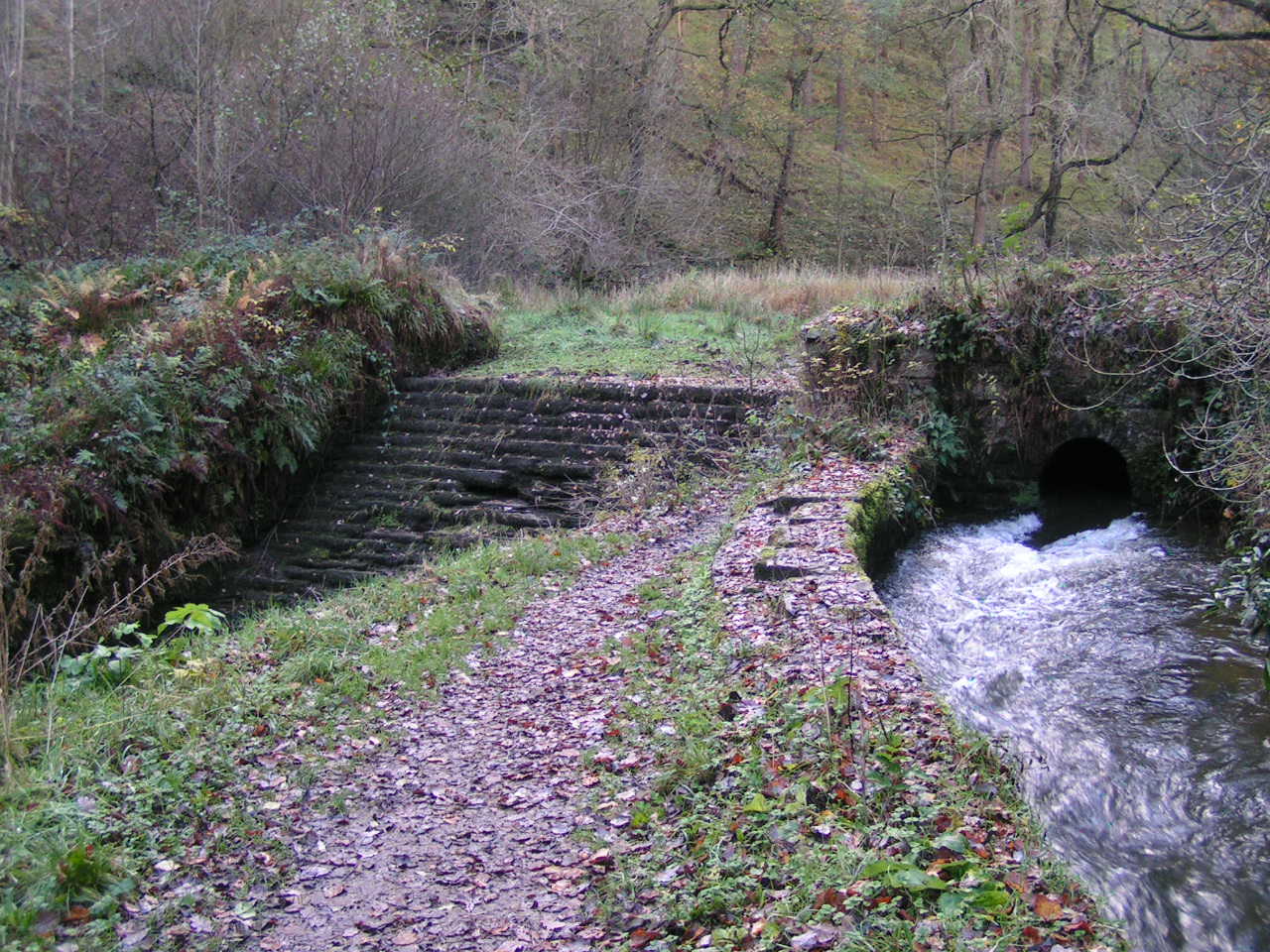
Todd Brook Derbyshire. Near w:Whaley Bridge. Weir and conduit, Todd Brook. At this point above w:Toddbrook Reservoir, water from Todd Brook flows either through a sluice into a conduit (right) or over a weir (left) and into the Reservoir. OSGB36: geotagged! SJ 998 805 [100m precision] WGS84: 53:19.2855N 2:0.2678W |
|---|---|
| Source |
From geograph.org.uk |
| Date |
2005 |
| Author | |
| Permission (Reusing this image) |
Creative Commons Attribution Share-alike license 2.0 |
| This image was taken from the Geograph project collection. See this photograph's page on the Geograph website for the photographer's contact details. The copyright on this image is owned by Dave Dunford and is licensed for reuse under the Creative Commons Attribution-ShareAlike 2.0 license. |
| This file is licensed under Creative Commons Attribution ShareAlike 2.0 License (cc-by-sa-2.0). In short: you are free to share and make derivative works of the file under the conditions that you appropriately attribute it, and that you distribute it under this or a similar cc-by-sa license. |
File history
Click on a date/time to view the file as it appeared at that time.
| Date/Time | Dimensions | User | Comment | |
|---|---|---|---|---|
| current | 17:34, 16 May 2008 | 640×480 (171 KB) | Victuallers | ({{Information |Description=Todd Brook Derbyshire. Near w:Whaley Bridge. Weir and conduit, Todd Brook. At this point above w:Toddbrook Reservoir, water from Todd Brook flows either through a sluice into a conduit (right) or over a ) |
File links
The following pages on the English Wikipedia link to this file (pages on other projects are not listed):

