Image:The Mi'kmaq.png
From Wikipedia, the free encyclopedia
Size of this preview: 800 × 559 pixels
Full resolution (1,180 × 824 pixels, file size: 418 KB, MIME type: image/png)
| | This is a file from the Wikimedia Commons. The description on its description page there is shown below.
|
[edit] Beschreibung
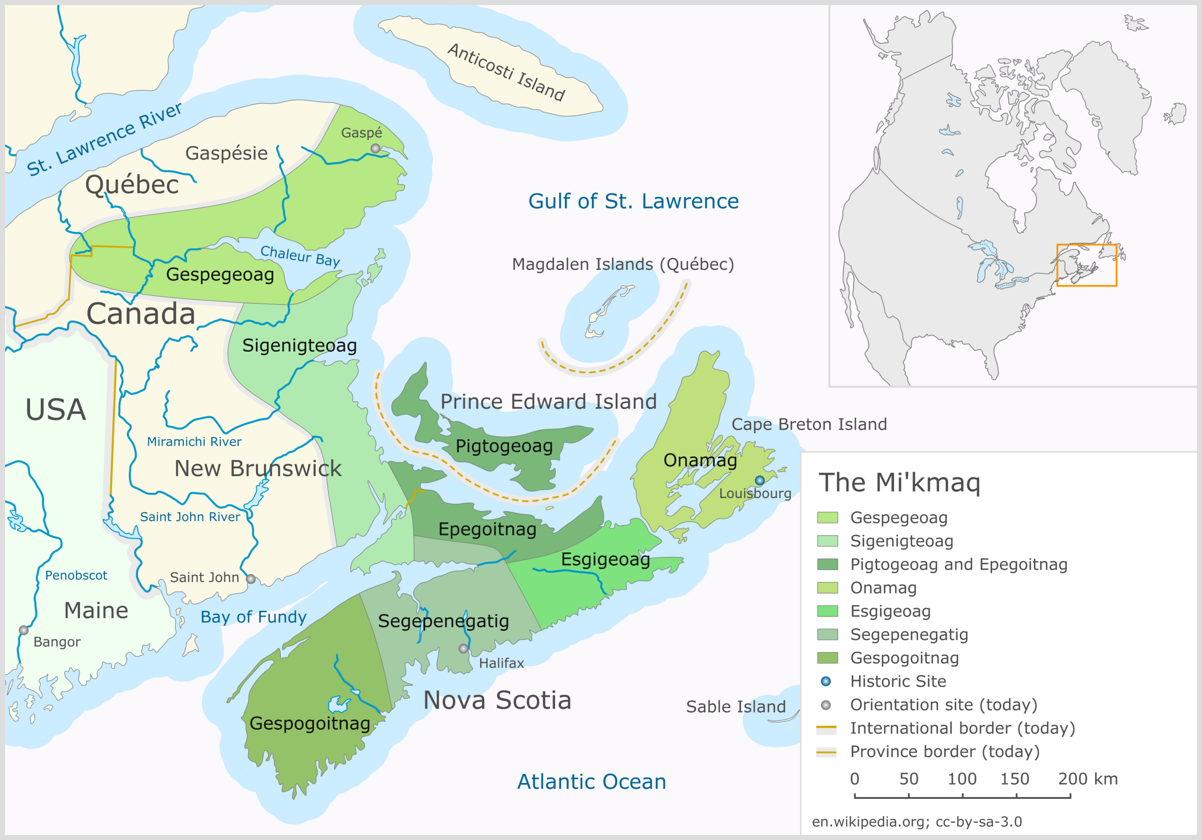
| Description |
The Mi'kmaq |
|---|---|
| Source |
Image (Map) made by Klaus Mueller (Mikmaq), Germany |
| Date |
20-07-2006 |
| Author |
Klaus Mueller |
| Permission (Reusing this image) |
CC-BY-SA-2.5 |
| Other versions |


|
Epikwitk and Piktuk territories should be reversed--24.222.11.210 16:23, 8 August 2006 (UTC)
- Very nice map! English version should show "Chaleur Bay" and not "Chaleur Bucht". Also, should show "Saint John" and not "St. John" as this city does not use abbreviations.198.166.214.5 13:10, 11 January 2007 (UTC)
[edit] Licensing
|
File history
Click on a date/time to view the file as it appeared at that time.
| Date/Time | Dimensions | User | Comment | |
|---|---|---|---|---|
| current | 04:11, 6 January 2008 | 1,180×824 (418 KB) | Ketiltrout | (minor textual corrections) |
| 07:36, 20 July 2006 | 1,180×824 (381 KB) | Mikmaq | (The Mi'kmaq) |
File links
The following pages on the English Wikipedia link to this file (pages on other projects are not listed):

