Image:The Ghan route map.png
From Wikipedia, the free encyclopedia
Size of this preview: 650 × 600 pixels
Full resolution (1,300 × 1,200 pixels, file size: 288 KB, MIME type: image/png)
| | This is a file from the Wikimedia Commons. The description on its description page there is shown below.
|
[edit] Summary
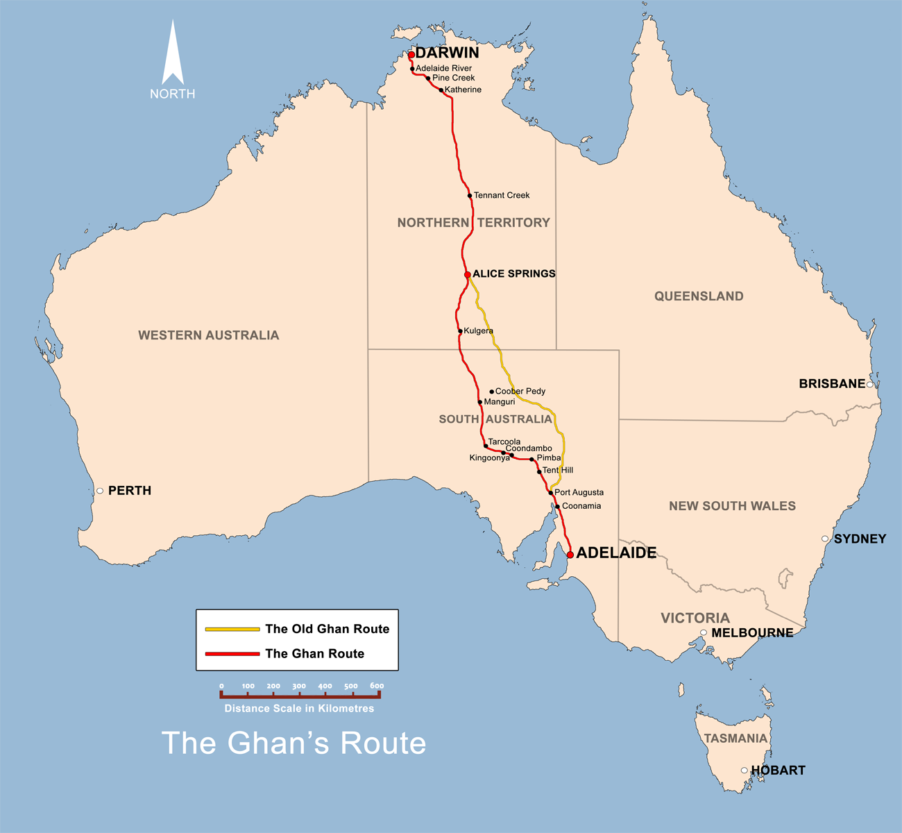
| Description |
The Ghan route map created by Bidgee based on other Ghan route maps on the internet which are low resolution and are not free to use. |
|---|---|
| Source |
self-made |
| Date |
20th May 2008 |
| Author | |
| Permission (Reusing this image) |
see below |
| Other versions |  |
[edit] Licensing:
|
File history
Click on a date/time to view the file as it appeared at that time.
| Date/Time | Dimensions | User | Comment | |
|---|---|---|---|---|
| current | 19:22, 13 June 2008 | 1,300×1,200 (288 KB) | Bidgee | (Update {{ImageUpload|basic}}) |
| 09:39, 20 May 2008 | 1,200×1,121 (491 KB) | Bidgee | (Correcting font sizes) | |
| 09:06, 20 May 2008 | 1,200×1,121 (486 KB) | Bidgee | (fix state and territory borders.) | |
| 08:15, 20 May 2008 | 1,200×1,121 (415 KB) | Bidgee | (Image fix ) | |
| 07:55, 20 May 2008 | 1,200×1,121 (415 KB) | Bidgee | ({{Information |Description=The Ghan route map created by Bidgee based on other Ghan route maps on the internet which are low resolution and are not free to use. |Source=self-made |Date=20th May 2008 |Author= Bidgee |Permiss) |
File links
The following pages on the English Wikipedia link to this file (pages on other projects are not listed):

