Image:Tehran Night Panorama.jpg
From Wikipedia, the free encyclopedia
Size of this preview: 800 × 122 pixels
Full resolution (4,603 × 700 pixels, file size: 470 KB, MIME type: image/jpeg)
| | This is a file from the Wikimedia Commons. The description on its description page there is shown below.
|
| Description |
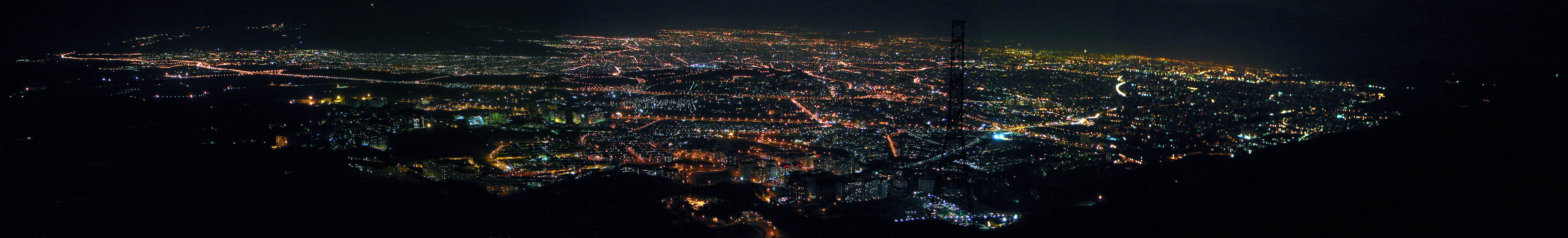
Tehran, Iran. Generated from 7 shots. Tehran is one of the biggest cities all over the world, it is 250km from east to west and 50 km from north to south! |
|---|---|
| Source | |
| Date |
April 17, 2006 at 11:02 |
| Author |
Hamed Saber from Tehran, Iran |
| Permission (Reusing this image) |
see below |
| Camera location |
|
Google Maps - Live Maps - Trails.com - TerraServer-USA |
|---|
[edit] Licensing
| This file is licensed under Creative Commons Attribution 2.0 License |
 |
This image was originally posted to Flickr by Hamed Saber at http://flickr.com/photos/44124425616@N01/139592515. It was reviewed on 11:09, 5 February 2008 (UTC) by FlickreviewR, and confirmed to be licensed under the terms of the cc-by-2.0. |
File history
Click on a date/time to view the file as it appeared at that time.
| Date/Time | Dimensions | User | Comment | |
|---|---|---|---|---|
| current | 19:25, 28 January 2008 | 4,603×700 (470 KB) | Jacoplane | ({{Information |Description= Breaking news! (2006/07/08): '' With my new pro account, I replaced the panorama with a larger size. (Not the original, but a bigger one. Although this is my first panorama try and has too many problems!) You can view the detai) |
File links
The following pages on the English Wikipedia link to this file (pages on other projects are not listed):
Metadata
This file contains additional information, probably added from the digital camera or scanner used to create or digitize it. If the file has been modified from its original state, some details may not fully reflect the modified file.
| Orientation | Normal |
|---|---|
| Horizontal resolution | 27/1 |
| Vertical resolution | 27/1 |
| Software used | Adobe Photoshop 7.0 ME |
| File change date and time | 11:02, 17 April 2006 |
| Color space | 65535 |

