Image:Sydney north tram map.png
From Wikipedia, the free encyclopedia
Size of this preview: 582 × 599 pixels
Full resolution (2,999 × 3,088 pixels, file size: 738 KB, MIME type: image/png)
| | This is a file from the Wikimedia Commons. The description on its description page there is shown below.
|
[edit] Summary
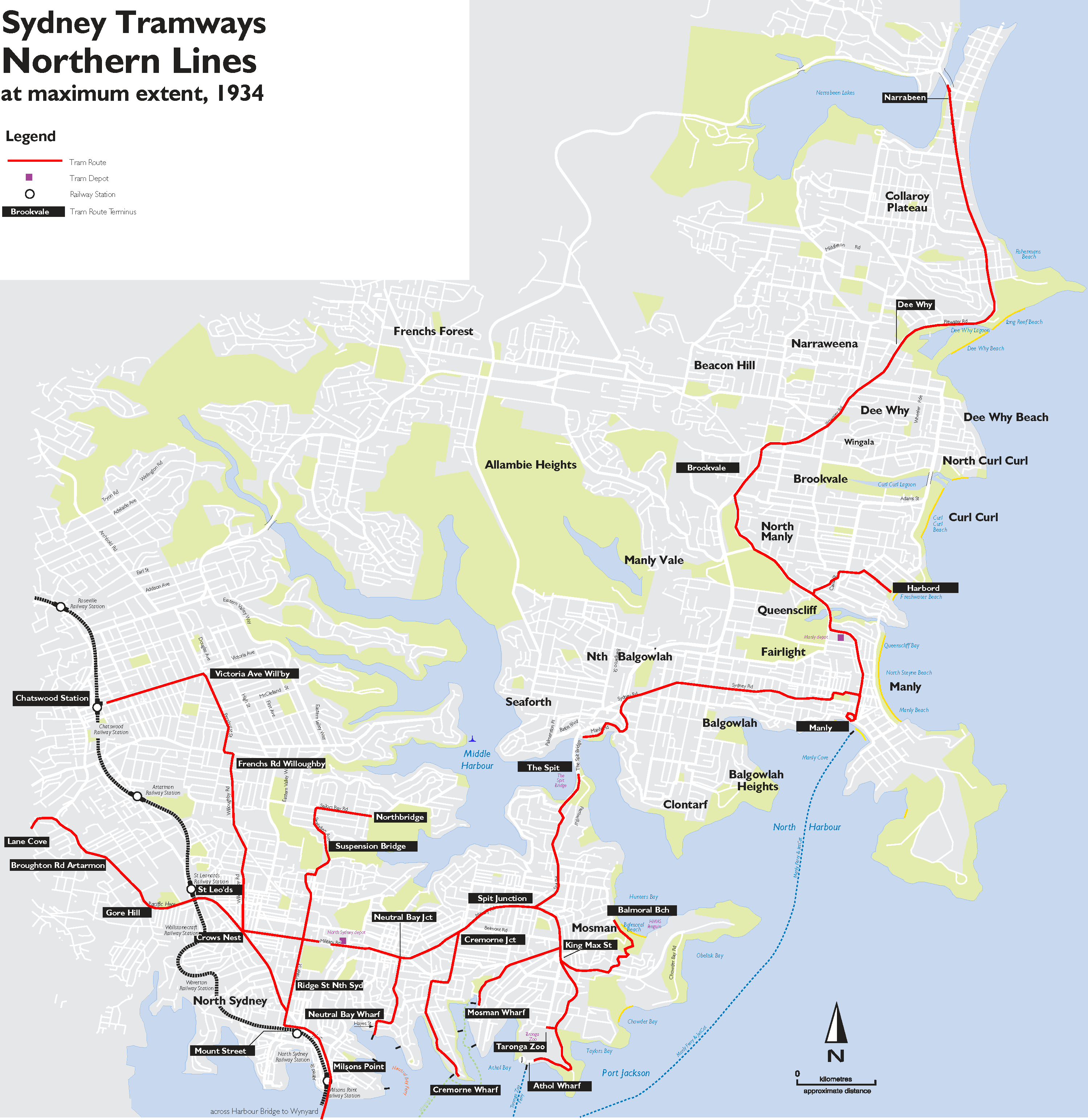
| Description |
Map of the tramways of the northern suburbs of Sydney at maximum extent, 1934 |
|---|---|
| Source |
self-made |
| Date |
5 March 2008 |
| Author | |
| Permission (Reusing this image) |
see below |
[edit] Licensing:
|
File history
Click on a date/time to view the file as it appeared at that time.
| Date/Time | Dimensions | User | Comment | |
|---|---|---|---|---|
| current | 04:26, 17 March 2008 | 2,999×3,088 (738 KB) | Quaidy | ({{Information |Description= Map of the tramways of the northern suburbs of Sydney at maximum extent, 1934 |Source=self-made |Date=5 March 2008 |Location= |Author=Quaidy (talk) |other_versions= }} [[Category:Public) |
File links
The following pages on the English Wikipedia link to this file (pages on other projects are not listed):

