Image:Sydney districts 1824.jpg
From Wikipedia, the free encyclopedia
Size of this preview: 616 × 599 pixels
Full resolution (1,063 × 1,034 pixels, file size: 360 KB, MIME type: image/jpeg)
| | This is a file from the Wikimedia Commons. The description on its description page there is shown below.
|
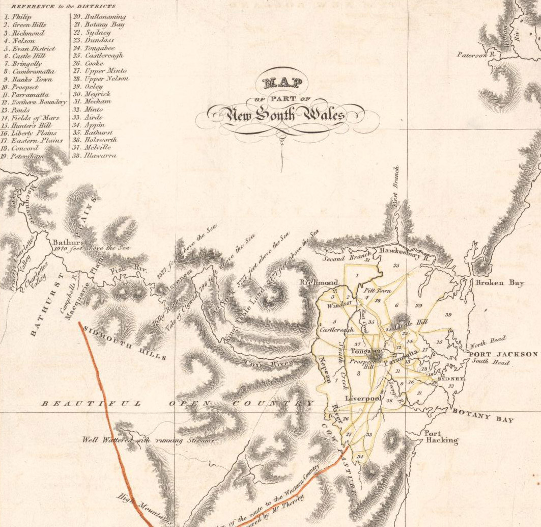
Map of districts in Sydney, 1824. Old map from the National Library, located here
Title:Map of Van Diemans Land; Map of part of New South Wales [cartographic material] / drawn & engraved by W. H. Lizars Edinr. Creator: Lizars, W. H. (William Home), 1788-1859.
This image was created in Australia and is now in the public domain because its term of copyright has expired. According to the Australian Copyright Council (ACC), ACC Information Sheet G23 (Duration of copyright) (Sep 2005).
1 means the typographical arrangement and layout of a published work. eg. newsprint. |
|
|||||||||||||||||||
File history
Click on a date/time to view the file as it appeared at that time.
| Date/Time | Dimensions | User | Comment | |
|---|---|---|---|---|
| current | 12:08, 3 April 2007 | 1,063×1,034 (360 KB) | Roke | (Map of districts in Sydney, 1824. Old map from the National Library, located [http://nla.gov.au/nla.map-nk2456-106 here] Title:Map of Van Diemans Land; Map of part of New South Wales [cartographic material] / drawn & engraved by W. H. Lizars Edinr. Creat) |
File links
Metadata
This file contains additional information, probably added from the digital camera or scanner used to create or digitize it. If the file has been modified from its original state, some details may not fully reflect the modified file.
| Orientation | Normal |
|---|---|
| Horizontal resolution | 72 dpi |
| Vertical resolution | 72 dpi |
| Software used | Adobe Photoshop CS2 Windows |
| File change date and time | 21:39, 3 April 2007 |
| Color space | 65535 |

