Image:Surface-to-Air Missile Coverage over the Taiwan Strait.png
From Wikipedia, the free encyclopedia
Size of this preview: 596 × 599 pixels
Full resolution (769 × 773 pixels, file size: 256 KB, MIME type: image/png)
| | This is a file from the Wikimedia Commons. The description on its description page there is shown below.
|
| Description |
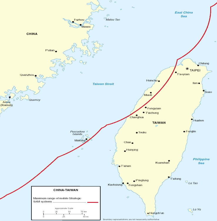
Figure 7. Surface-to-Air Missile Coverage over the Taiwan Strait. Note: This map depicts notional coverage provided by China’s SA-10, SA-20 SAM systems, as well as the soon-to-be acquired S-300PMU2. Actual coverage would be non-contiguous and dependent upon precise deployment sites. |
|||
|---|---|---|---|---|
| Source | ||||
| Date |
05/23/06 |
|||
| Author |
DoD |
|||
| Permission (Reusing this image) |
|

File history
Click on a date/time to view the file as it appeared at that time.
| Date/Time | Dimensions | User | Comment | |
|---|---|---|---|---|
| current | 08:40, 26 May 2006 | 769×773 (256 KB) | Shizhao | ({{Information |Description=Figure 7. Surface-to-Air Missile Coverage over the Taiwan Strait. Note: This map depicts notional coverage provided by China’s SA-10, SA-20 SAM systems, as well as the soon-to-be acquired S-300PMU2. Actual coverage would be n) |
File links
The following pages on the English Wikipedia link to this file (pages on other projects are not listed):

