Image:Sulawesi map.PNG
From Wikipedia, the free encyclopedia
Size of this preview: 543 × 599 pixels
Full resolution (1,492 × 1,647 pixels, file size: 83 KB, MIME type: image/png)
| | This is a file from the Wikimedia Commons. The description on its description page there is shown below.
|
[edit] Summary
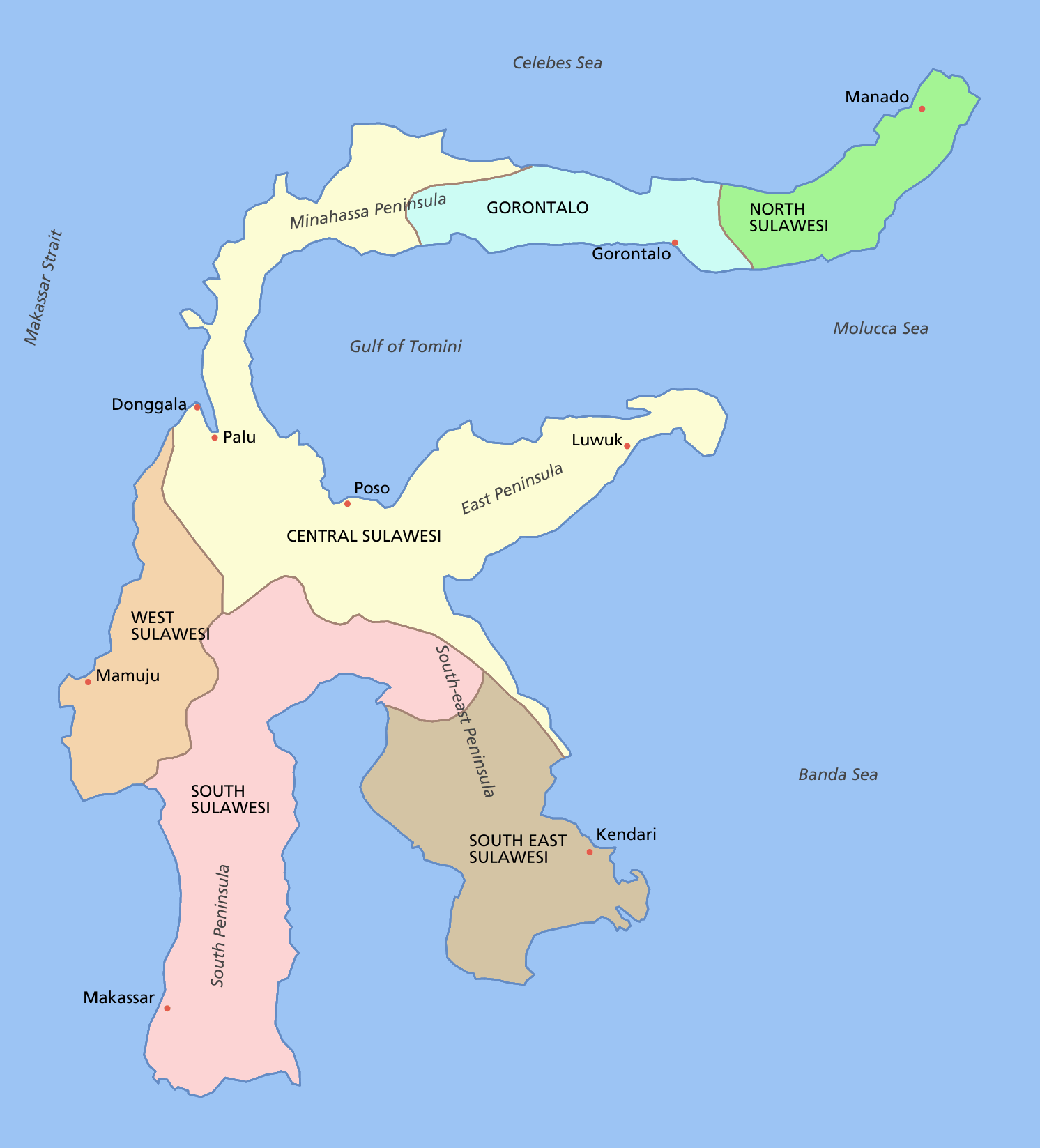
Sulawesi showing provinces, their capital cities, a few other cities and some surrounding areas of water. Note that there are other islands in this area which are not shown as this is a map of Sulawesi island itself.
For a blank map see Image:Sulawesi blank.PNG
[edit] Licensing

File history
Click on a date/time to view the file as it appeared at that time.
| Date/Time | Dimensions | User | Comment | |
|---|---|---|---|---|
| current | 12:11, 11 March 2006 | 1,492×1,647 (83 KB) | Roke | (fixed borders of provinces) |
| 04:55, 11 March 2006 | 1,492×1,647 (82 KB) | Roke | (Sulawesi showing provinces, their capital cities, a few other cities and some surrounding areas of water. Note that there are other islands in this area which are not shown as this is a map of Sulawesi island itself. Category:Sulawesi [[Category:Maps) |
File links
The following pages on the English Wikipedia link to this file (pages on other projects are not listed):

