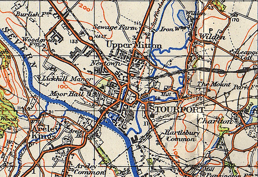
Image:Stourport-on-Severn OS map 1942.jpg
From Wikipedia, the free encyclopedia
Size of this preview: 800 × 549 pixels
Full resolution (874 × 600 pixels, file size: 373 KB, MIME type: image/jpeg)
| | This is a file from the Wikimedia Commons. The description on its description page there is shown below.
|
File history
Click on a date/time to view the file as it appeared at that time.
| Date/Time | Dimensions | User | Comment | |
|---|---|---|---|---|
| current | 23:23, 10 May 2007 | 874×600 (373 KB) | Loganberry | ({{Information |Description=w:Stourport-on-Severn and surrounding area |Source=w:Ordnance Survey map one-inch sheet 71 (Second War Revision 1940) entitled "Kidderminster" |Date=1942 |Author=Map by w:Ordnance Survey; scan by User:Loganberry ) |
File links
The following pages on the English Wikipedia link to this file (pages on other projects are not listed):

