Image:StLawrence Gulf bathymetry.jpg
From Wikipedia, the free encyclopedia
Size of this preview: 800 × 493 pixels
Full resolution (820 × 505 pixels, file size: 90 KB, MIME type: image/jpeg)
| | This is a file from the Wikimedia Commons. The description on its description page there is shown below.
|
[edit] Summary
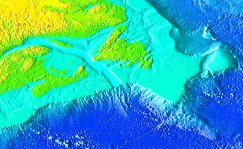
Bathymetry near the Gulf of Saint Lawrence.
Source: http://www.ngdc.noaa.gov/mgg/image/2minrelief.html
[edit] Licensing
| This work is in the public domain in the United States because it is a work of the United States Federal Government under the terms of Title 17, Chapter 1, Section 105 of the US Code. See Copyright.
Note: This only applies to works of the Federal Government and not to the work of any individual U.S. state, territory, commonwealth, county, municipality, or any other subdivision. العربية | Български | Česky | Deutsch | English | Español | Français | Magyar | Italiano | 日本語 | 한국어 | Polski | Português | 中文(繁體) | 中文(简体) | +/- |
 |
File history
Click on a date/time to view the file as it appeared at that time.
| Date/Time | Dimensions | User | Comment | |
|---|---|---|---|---|
| current | 17:50, 15 March 2007 | 820×505 (90 KB) | Interiot | (expand to include the w:Flemish Cap) |
| 19:10, 14 March 2006 | 733×422 (97 KB) | Interiot | (frame it a little differently) | |
| 19:07, 14 March 2006 | 776×396 (103 KB) | Interiot | (== Summary == Bathymetry near the Gulf of Saint Lawrence. Source: http://www.ngdc.noaa.gov/mgg/image/2minrelief.html == Licensing == {{PD-USGov}} Category:Ocean topography ) |
File links
The following pages on the English Wikipedia link to this file (pages on other projects are not listed):

