Image:Southern ocean gravity hg.png
From Wikipedia, the free encyclopedia
Size of this preview: 800 × 558 pixels
Full resolution (1,155 × 806 pixels, file size: 1.18 MB, MIME type: image/png)
| | This is a file from the Wikimedia Commons. The description on its description page there is shown below.
|
| Description |
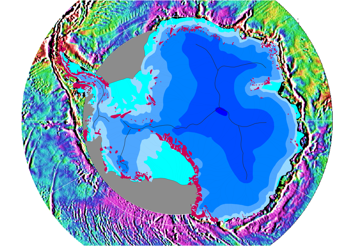
Gravity map of the Southern Ocean around the Antarctic continent This gravity field was computed from sea-surface height measurements collected by the US Navy GEOSAT altimeter between March, 1985, and January, 1990. The high density GEOSAT Geodetic Mission data that lie south of 30 deg. S were declassified by the Navy in May of 1992 and contribute most of the fine-scale gravity information. The Antarctic continent itself is shaded in blue depending on the thickness of the ice sheet (blue shades in steps of 1000 m); light blue is shelf ice; gray lines are the major ice devides; pink spots are parts of the continent which are not covered by ice; gray areas have no data. |
|---|---|
| Source |
Antarctic continent: own work; gravity field: NOAA/NGDC (Marks, McAdoo & Smith) |
| Date |
2006-08-08 |
| Author |
Hannes Grobe, AWI |
| Permission (Reusing this image) |
Own work and public domain of NOAA |
| Other versions | Gravity data are available from the National Oceanographic Data Center, NOAA (NODC Env. Bull. 93-1); the digital gravity data shown in this image are available from the National Geophysical Data Center on the Global Relief CD-ROM (NGDC Data Announcement 93-MGG-01). See the GIF image at NGDC. |
| This image is in the public domain because it contains materials that originally came from the U.S. National Oceanic and Atmospheric Administration, taken or made during the course of an employee's official duties. |
|
File history
Click on a date/time to view the file as it appeared at that time.
| Date/Time | Dimensions | User | Comment | |
|---|---|---|---|---|
| current | 21:53, 12 August 2006 | 1,155×806 (1.18 MB) | Hgrobe | ({{Information| |Description=Gravity map of the Southern Ocean around the Antarctic continent |Source=own work |Date=2006-08-08 |Author=~~~~ |Permission=Own work, share alike, attribution required (Creative Commons CC-BY-SA-2.5) |other_versions= }} {{self) |

