Image:Somerset Coal Canal Map.png
From Wikipedia, the free encyclopedia
Size of this preview: 800 × 477 pixels
Full resolution (2,181 × 1,300 pixels, file size: 996 KB, MIME type: image/png)
| | This is a file from the Wikimedia Commons. The description on its description page there is shown below.
|
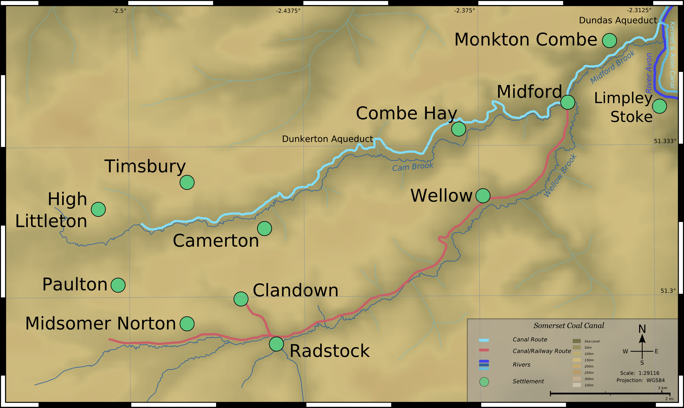
Map of Somerset Coal Canal (now demolished), Somerset, England.
Topographical Data derived from NASA SRTM, PD.
Map detail derived from 1890 OS Mapping, PD by Berne Convention.
| This file is licensed under Creative Commons Attribution 2.5 License In short: you are free to distribute and modify the file as long as you attribute its author(s) or licensor(s). |
File history
Click on a date/time to view the file as it appeared at that time.
| Date/Time | Dimensions | User | Comment | |
|---|---|---|---|---|
| current | 10:57, 29 October 2006 | 2,181×1,300 (996 KB) | SFC9394 | (Map of Somerset Coal Canal (now demolished), Somerset, England. Topographical Data derived from NASA SRTM, PD. Map detail derived from 1890 OS Mapping, PD by Berne Convention. {{CC-BY-2.5}} Category:Maps of canals) |
File links
The following pages on the English Wikipedia link to this file (pages on other projects are not listed):

