Image:Somers Isles Map - John Speed 1676.jpg
From Wikipedia, the free encyclopedia
Size of this preview: 800 × 519 pixels
Full resolution (2,744 × 1,781 pixels, file size: 2.86 MB, MIME type: image/jpeg)
| | This is a file from the Wikimedia Commons. The description on its description page there is shown below.
|
[edit] Summary
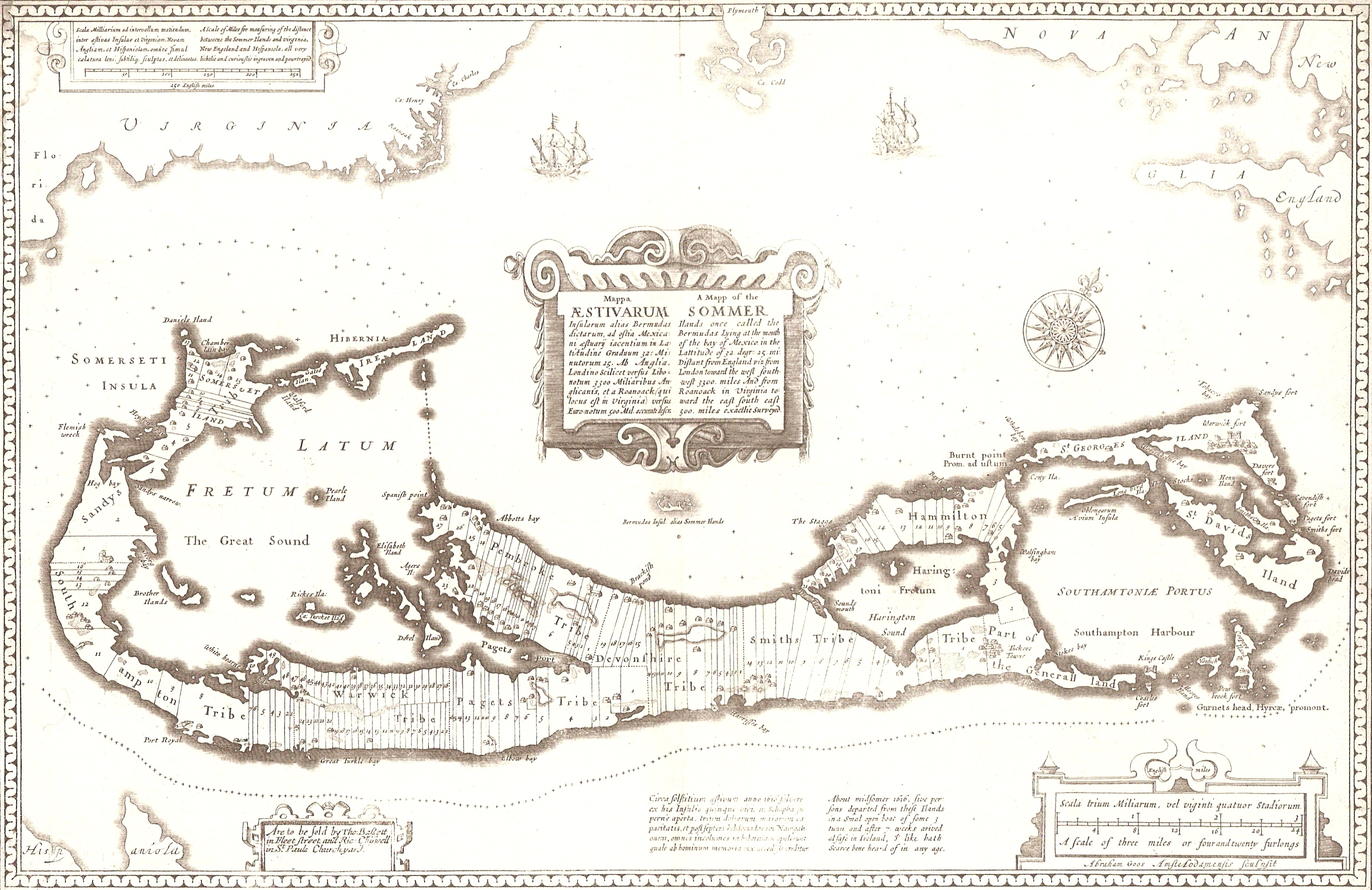
A 1676 map of the Somers Isles (alias Bermuda), by John Speed (based on the map of surveyor Richard Norwood). Clearly shown are the tribe roads cut parallel through the forest between the North and South Shores (except in St. Georges, the eastern-most subdivision, comprising the islands of St. George's and St. David'd, the South-Eastern tip of the Main Island, and the various smaller islands between. This was general land, and not commercial.
Aodhdubh 06:04, 26 February 2007 (UTC)
[edit] Licensing
| This image (or other media file) is in the public domain because its copyright has expired. This applies to the United States, Canada, the European Union and those countries with a copyright term of life of the author plus 70 years.
العربية | Asturianu | Български | Català | Česky | Dansk | Deutsch | English | Ελληνικά | Esperanto | Español | Euskara | فارسی | Français | Gaeilge | Galego | עברית | हिन्दी | Bahasa Indonesia | Italiano | 日本語 | 한국어 | Kurdî / كوردی | Lietuvių | Magyar | Nederlands | Norsk (nynorsk) | Bahasa Melayu | Polski | Português | Română | Русский | Slovenčina | Slovenščina | Shqip | Suomi | Sámegiella | Türkçe | 中文(简体) | 中文(繁體) | 粵語 | +/- |
File history
Click on a date/time to view the file as it appeared at that time.
| Date/Time | Dimensions | User | Comment | |
|---|---|---|---|---|
| current | 06:04, 26 February 2007 | 2,744×1,781 (2.86 MB) | Aodhdubh | (A 1676 map of the Somers Isles (alias Bermuda), by John Speed (based on the map of surveyor Richard Norwood). Clearly shown are the tribe roads cut parallel through the forest between the North and South Shores (except in St. Georges, the eastern-most sub) |

