Image:ShepherdMapRomanBritain410.PNG
From Wikipedia, the free encyclopedia
Size of this preview: 625 × 600 pixels
Full resolution (646 × 620 pixels, file size: 922 KB, MIME type: image/png)
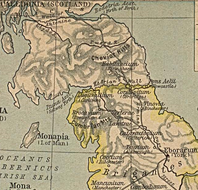
A section from William Shepard's map of Roman Britain about 410 (1923).
| This file has been released into the public domain by the copyright holder, its copyright has expired, or it is ineligible for copyright. This applies worldwide. | ||||
|
||||
File history
Click on a date/time to view the file as it appeared at that time.
| Date/Time | Dimensions | User | Comment | |
|---|---|---|---|---|
| current | 04:33, 23 July 2005 | 646×620 (922 KB) | Nesbit (Talk | contribs) | (A section from William Shepard's map of Roman Britain about 410 (1923). {{PD-OLD}}) |
- Search for duplicate files
- Edit this file using an external application
See the setup instructions for more information.
File links
The following pages on the English Wikipedia link to this file (pages on other projects are not listed):

