Image:SFO map.png
From Wikipedia, the free encyclopedia
No higher resolution available.
SFO_map.png (405 × 583 pixels, file size: 57 KB, MIME type: image/png)
| | This is a file from the Wikimedia Commons. The description on its description page there is shown below.
|
[edit] Summary
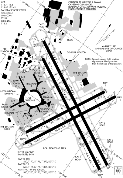
Detail from FAA diagram of San Francisco International Airport. Warning, this diagram contains material which is subject to change, do not use for navigation.
[edit] Licensing
| This image is a work of a Federal Aviation Administration employee, taken or made during the course of an employee's official duties. As works of the U.S. federal government, all FAA images are in the public domain. |  |
File history
Click on a date/time to view the file as it appeared at that time.
| Date/Time | Dimensions | User | Comment | |
|---|---|---|---|---|
| current | 23:14, 16 December 2005 | 405×583 (57 KB) | Sam916 | (==Summary== Detail from FAA diagram of San Francisco International Airport. Warning, this diagram contains material which is subject to change, do not use for navigation. ==Licensing== {{PD-USGov-FAA}} ) |
File links
The following pages on the English Wikipedia link to this file (pages on other projects are not listed):

