Image:Seraing Liège Belgium Map.png
From Wikipedia, the free encyclopedia
No higher resolution available.
Seraing_Liège_Belgium_Map.png (290 × 220 pixels, file size: 7 KB, MIME type: image/png)
| | This is a file from the Wikimedia Commons. The description on its description page there is shown below.
|
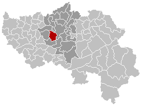
Français : localisation de la commune de Seraing dans la province de Liège
Walon: Mape des comenes del province di Lidje, avou Serè e rodje
English: Position of Seraing commune in the Liege province
| This image has been released into the public domain by its author, LennartBolks. This applies worldwide. In some countries this may not be legally possible; if so: العربية | Български | Deutsch | Ελληνικά | English | Español | Français | Italiano | 日本語 | 한국어 | Polski | Русский | Српски / Srpski | Svenska | தமிழ் | Українська | 中文(繁體) | 中文(简体) +/- |
File history
Click on a date/time to view the file as it appeared at that time.
| Date/Time | Dimensions | User | Comment | |
|---|---|---|---|---|
| current | 22:57, 24 December 2005 | 290×220 (7 KB) | Westermarck | |
| 22:08, 21 March 2005 | 290×220 (5 KB) | Srtxg |
File links
The following pages on the English Wikipedia link to this file (pages on other projects are not listed):

