Image:Seljuk Sultanate of Rum 1190 Locator Map.svg
From Wikipedia, the free encyclopedia

Seljuk_Sultanate_of_Rum_1190_Locator_Map.svg (SVG file, nominally 1440 × 750 pixels, file size: 171 KB)
| | This is a file from the Wikimedia Commons. The description on its description page there is shown below.
|
[edit] Summary
| Description |
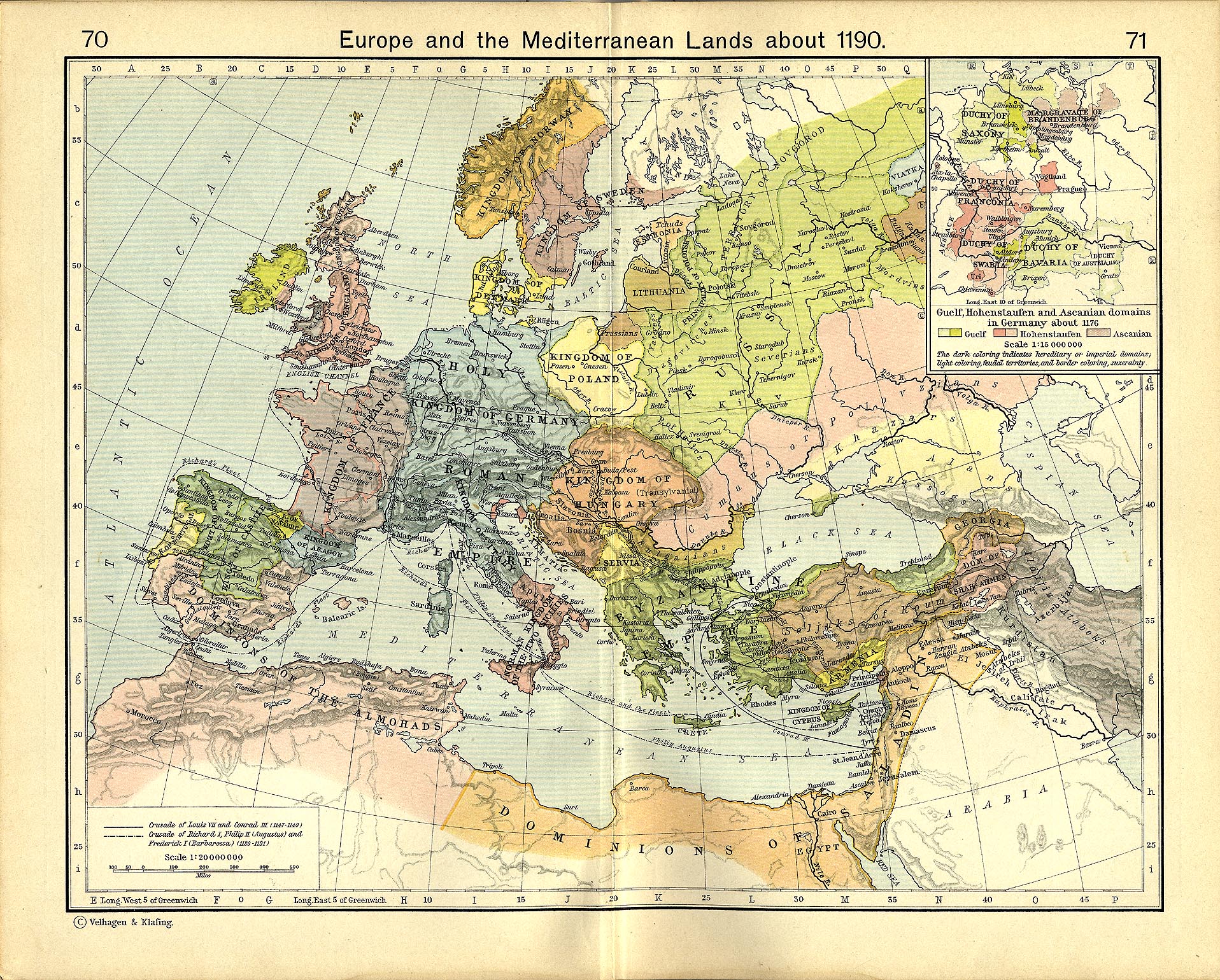
A locator map of the w:en:Seljuk Sultanate of Rum, with borders as of 1190. This map also shows locations for the following battles:
|
|---|---|
| Source |
self-made |
| Date |
14 Feb 2008 |
| Author | |
| Permission (Reusing this image) |
see below |
[edit] References
- Shepherd, William (1911) "Map of Europe and the Meditteraean Lands about 1190"
[edit] Licensing

File history
Click on a date/time to view the file as it appeared at that time.
| Date/Time | Dimensions | User | Comment | |
|---|---|---|---|---|
| current | 06:12, 24 February 2008 | 1,440×750 (171 KB) | MapMaster | (Added battle sites) |
| 23:13, 15 February 2008 | 1,440×750 (166 KB) | MapMaster | (Minor edits based on feedback from Aramgar) | |
| 04:35, 15 February 2008 | 1,440×750 (165 KB) | MapMaster | ({{Information |Description=A locator map of the w:en:Seljuk Sultanate of Rum, with borders as of 1190. |Source=self-made |Date=14 Feb 2008 |Author= MapMaster |Permission= |other_versions= }} ) |
File links
The following pages on the English Wikipedia link to this file (pages on other projects are not listed):

